
Good Tuesday afternoon everyone! I wanted to talk about our weather for the rest of the week with a bit of a discussion on the potential for some stronger storms Friday night into Saturday morning.
First lets talk about your weather for the rest of Today through most of Friday.
- Tuesday Evening: Mostly Cloudy skies will give way to mostly clear skies overnight with temperatures dropping into the upper 20s to low 30s across the area.
- Wednesday: Expect mostly cloudy skies through the day with a chance of showers in the afternoon. Highs are expected to be in the lower 50s. Not expecting significant rain totals. Skies will begin to clear overnight once again with temperatures falling into the mid 20s.
- Thursday: This will likely be the best day of the week as we see a good bit of sunshine with temperatures in the mid 50s. Thursday night will see clouds and showers move in mainly after midnight with lows in the lower 40s.
- Friday: Showers and possibly a thunderstorm or two will be around most of the day as our next system moves in. Highs will be in the mid to upper 60s during the day as a strong Southerly wind brings in some warm air.
Friday Night
As of the creation of this post, the Storm Prediction Center has most of the area under a chance for severe weather as part of the day 4 severe weather outlook which you can see below.
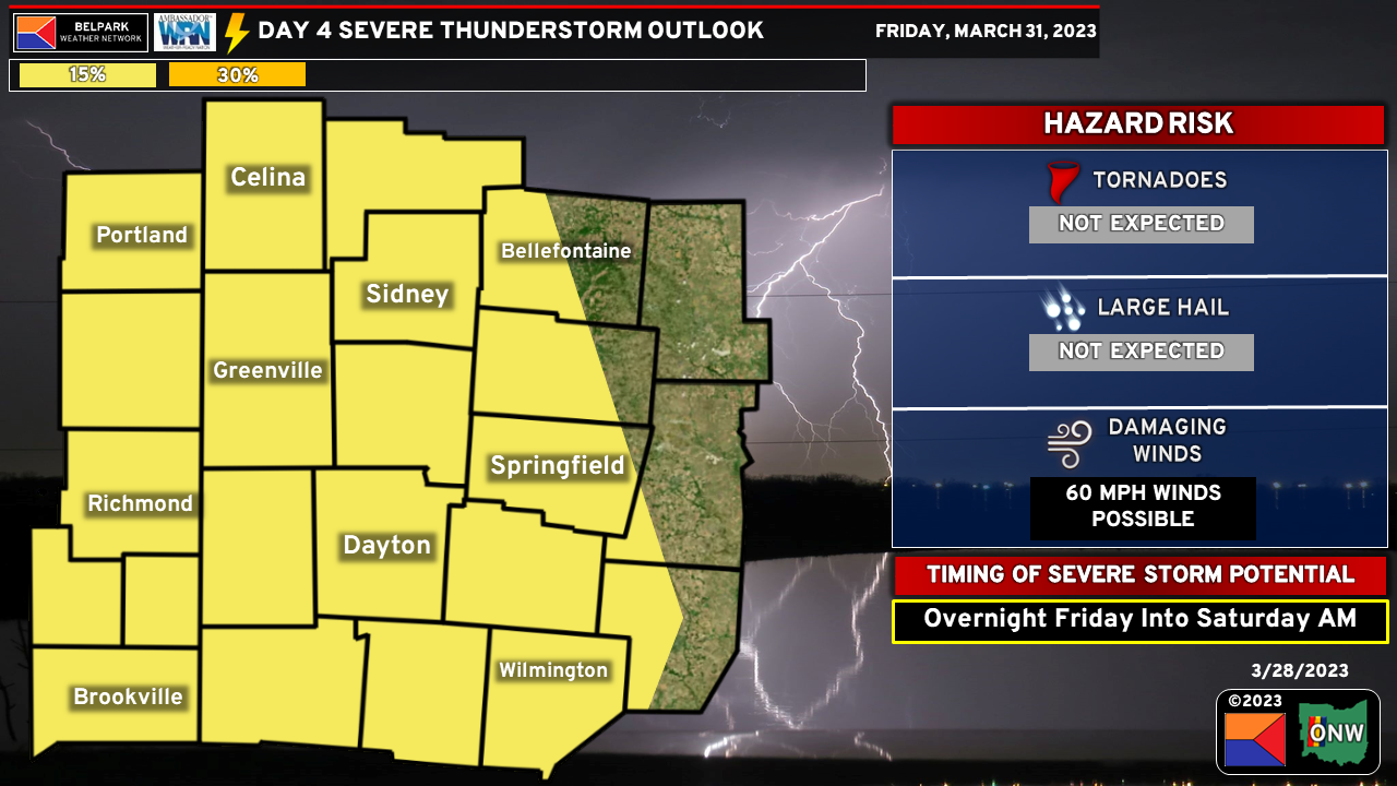
The main threat would look to come in the overnight hours in the form of strong to potentially damaging winds. The timing and overall thermodynamic environment does not look very supportive of severe weather at this time. That being said, the wind fields will already be fairly strong as a strengthening area of low pressure tracks from the Midwest toward the Great Lakes. The only thing we would need is a way to mix some of the stronger winds above our heads down to the surface, which an approaching cold front may provide.
There are still some questions regarding the strength of the low pressure and the overall track of the low pressure but it’s not every day we are included in a day 4 severe weather risk so it is worth keeping an eye on.
As always we will keep you updated through the week on our family of social media pages as part of the Belpark Weather Network!