
Written by – Forecaster: Nick Dunn
Columbus, OH (BWN) – Good evening, everyone! The first full day of Spring was a nice one, but it will likely go down as the nicest day until at least the second half of the weekend. We have had a wet start to 2023 for many areas, and another unsettled pattern is about to move into the region. Multiple chances of showers and even thunderstorms will start as early as tomorrow, with several inches of rain possible. Let’s dive into the setup!
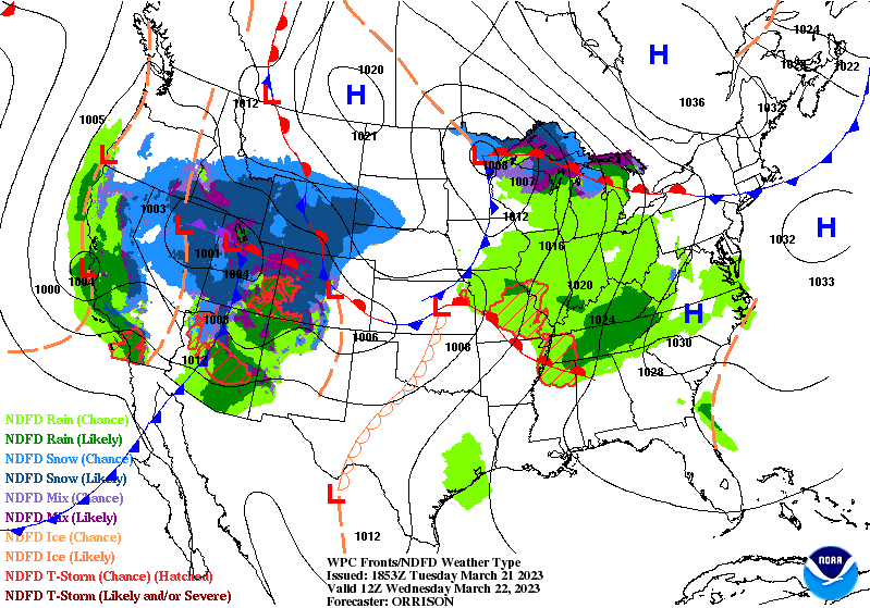
At the surface by tomorrow morning, some light rain showers will be impacting the region. Overall, this moisture is not overly impressive and rainfall will be light in nature. It will be a bit cooler Wednesday with highs in the upper 40s to middle 50s in most areas. Rainfall totals for Wednesday should be unimpressive, and stay under 1/4 inch.
By Thursday, a warm front will lift north across the Ohio Valley, accompanied by a cold front and an area of low pressure. Heavier rains are likely on Thursday, especially north of I-70 based on current model guidance. There remains some questions about the placement and intensity of this rain, but amounts over 1/2 inch are possible in some locations.
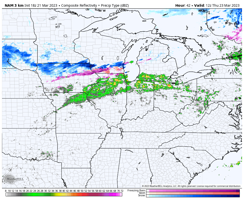
A cold front will stall out likely south of I-70 late Thursday into Friday as another disturbance moves into the region. This round of rain into Friday morning has the potential to be quite heavy with even some embedded thunderstorms. Rainfall amounts of 1-2″ are not out of the question.
There have already been some questions about severe weather for our local area. At this time, I feel it is quite low as there are too many variables still in play and we need to watch for models to hone in on more specifics regarding this setup before we see if severe weather is possible. Given the ample rounds of rain and cloudiness, one would think right away our threat of severe weather would stay low.
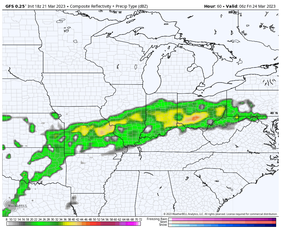
Moving into Friday Night and Saturday, another round of heavy rain appears possible again as another area of low pressure finally rides the boundary to move away from the area. There seems to be a risk of severe weather south of the Ohio valley for Friday, which the SPC has already placed an area of interest for in their Day 4 Outlook.
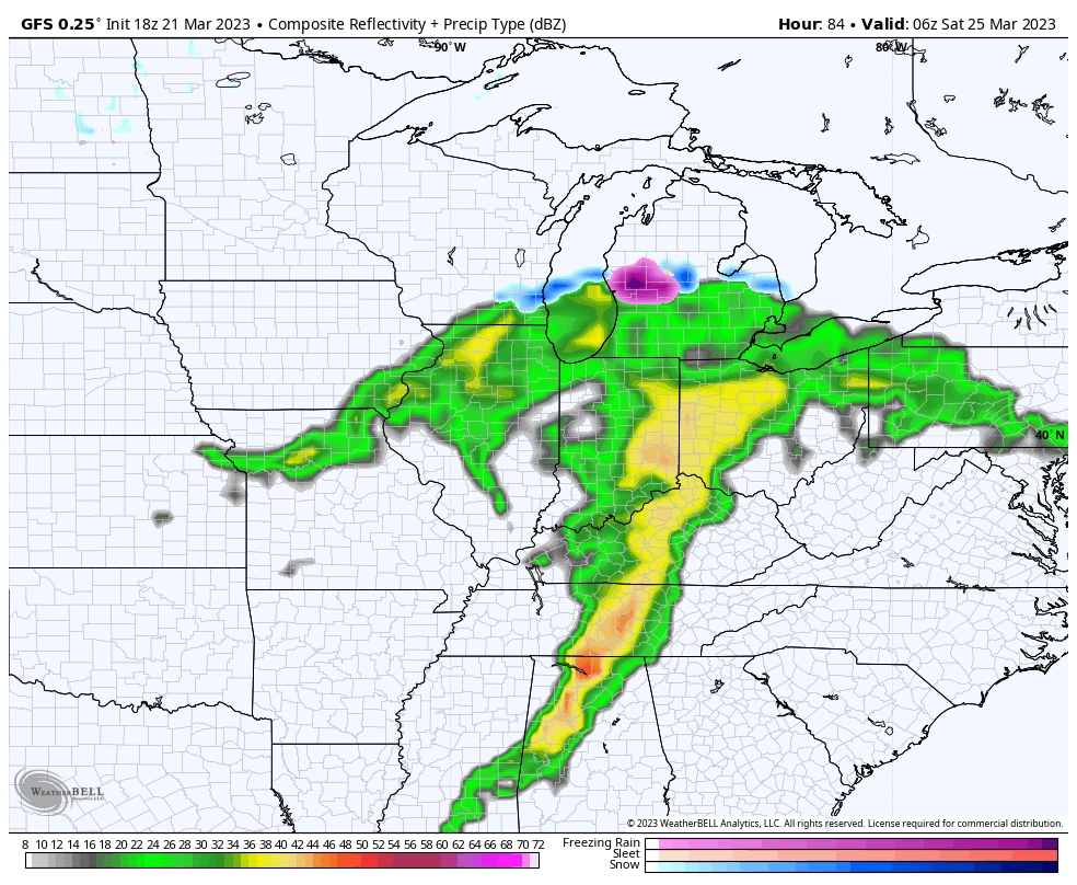
How much rain could we see? Models remain somewhat uncertain on the axis of heaviest rainfall, but the potential for 1-3″ or more of rain remains possible across the entire region, with a focal point being near and south of US-30 for the heaviest totals. We will have to fine tune this data as we continue to get closer. Our team will keep an eye on this as flooding risks are looking like a concern.