Written by: Nick Dunn
Good Tuesday morning, everyone! We are continuing to monitor what could be another very busy weather day on Wednesday. A strong storm system will be moving through the Great Lakes and Ohio Valley, firing off showers and thunderstorms. While convective evolution remains a bit murky, ingredients remain favorable for the risk of severe thunderstorms, some of which could become significant. This post is meant as a breakdown of the current convective outlook as of 2:30 AM Wednesday morning.
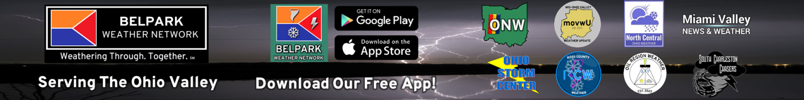
Before we get to Wednesday, it is worth noting that we do have a low-end risk of a strong to severe storm late tonight, after midnight. This risk seems rather isolated and the chances are quite low. The Storm Prediction Center has placed northwestern counties under a Level 1 Risk of severe weather with isolated hail or gusty winds. This will serve as a precursor to what could follow on Wednesday.
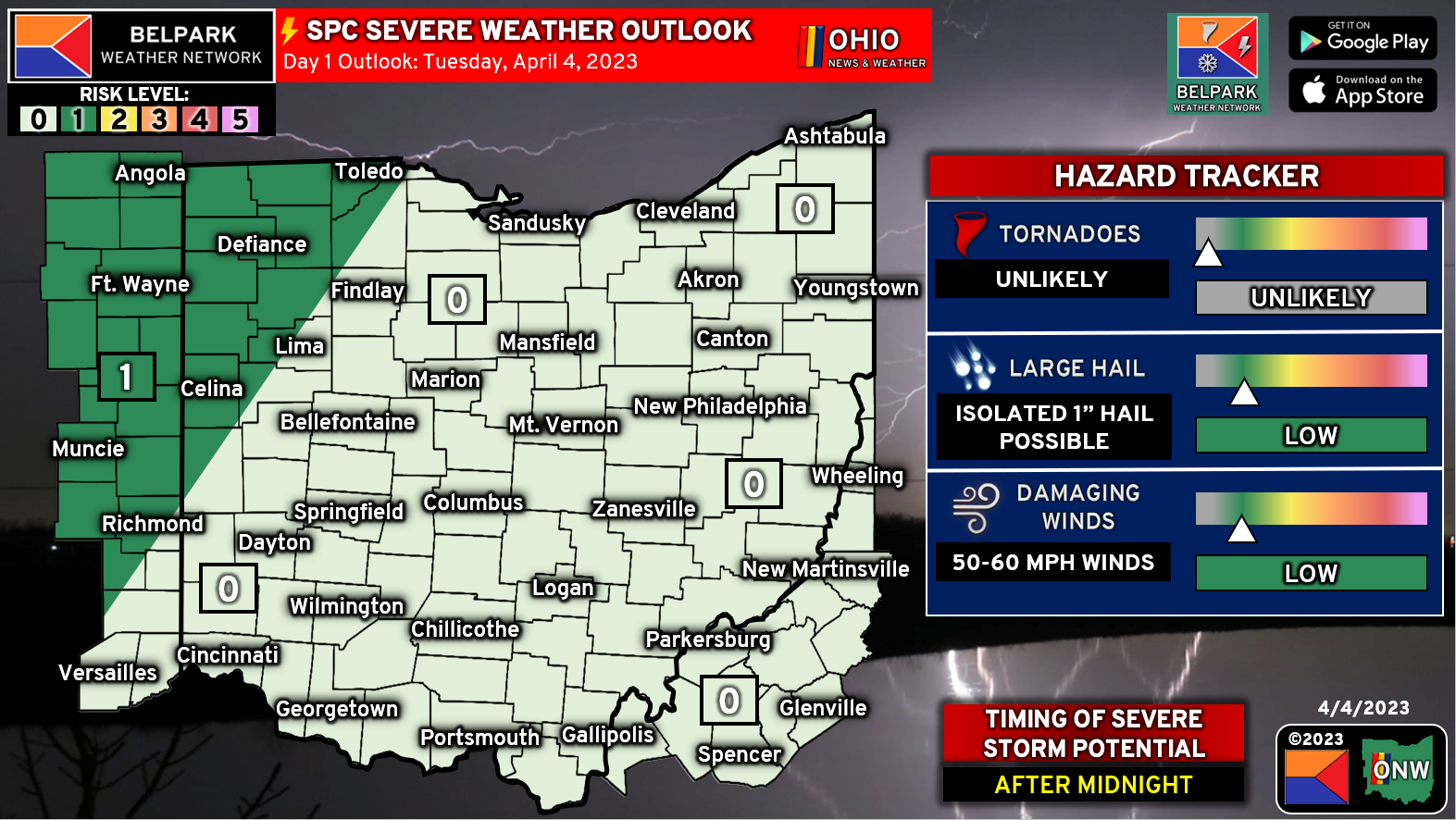
For Wednesday, the Storm Prediction Center has placed essentially the entire area under a Level 3 of 5 risk of severe weather, some of which could be significant. It is worth noting that this risk may come in multiple rounds and may contain a mix of supercells and lines of thunderstorms. The key here is that the timing has been a bit murky. However, for now we will go with a 2:00 PM Wednesday to 2:00 AM Thursday window, noting this can change.
HAZARD BREAKDOWN: Now for the meat of the post here. We recently added a hazard breakdown of each severe hazard and the SPC probabilistic map to help you understand which risk has the best chance of occurring in your region.
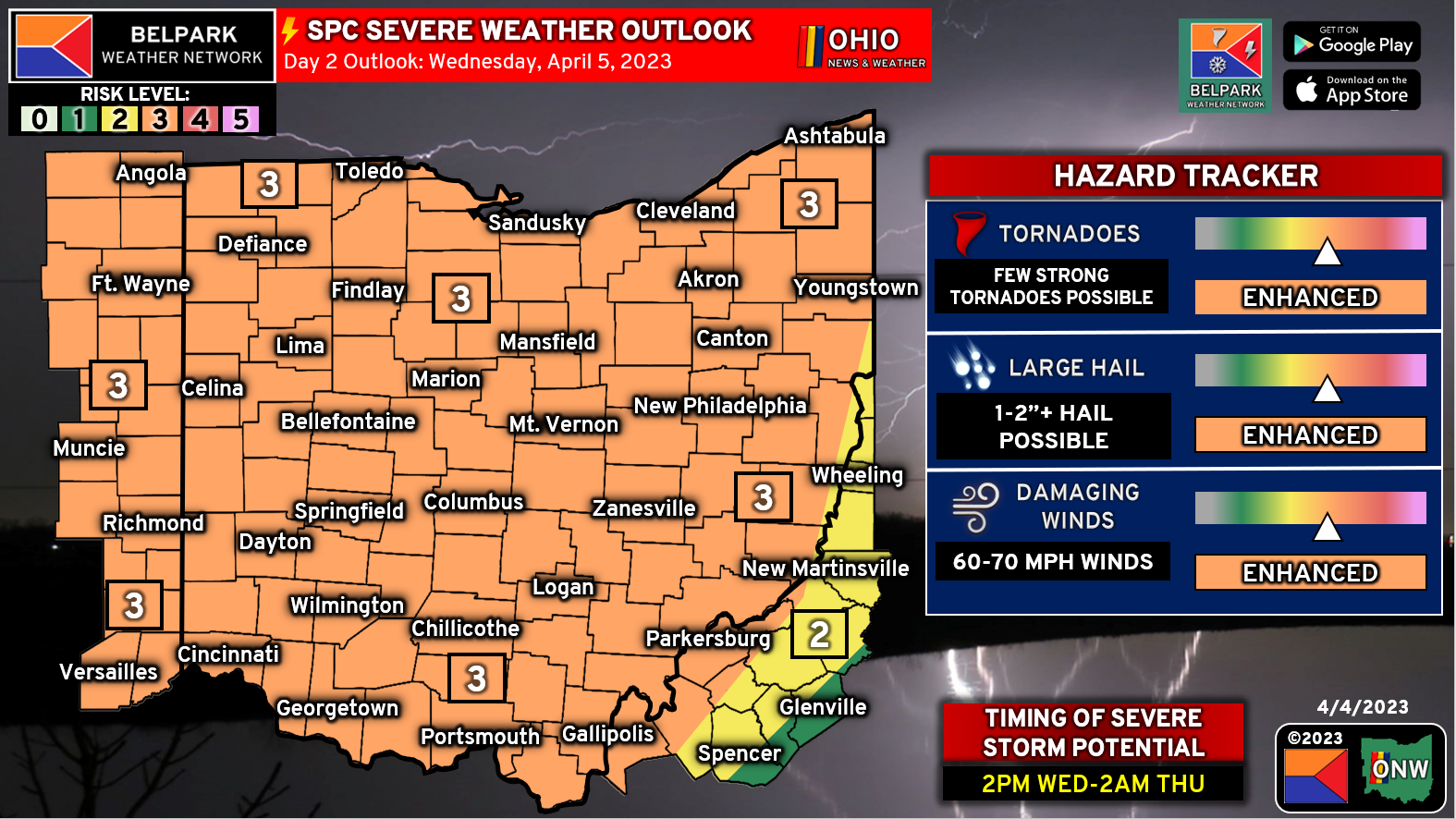
TORNADO: There is a risk of at least a few tornadoes. These could come from supercell storms or along a line of storms, similar to Friday. In addition, a risk of strong tornadoes (EF-2 or greater) was designated for northwestern counties (hatched area). This is not intended to scare you, but it is intended to show where the best chance of a strong tornado is likely to be. Even though the rest of the area, a few tornadoes are certainly possible. Given ample shear and at least modest instability, the tornado development aspect is there. Again, some uncertainty does exist with regard to how exactly this pans out, but the potential is there.
WIND: Damaging winds are also a possibility, with the best chances being in the 30% (RED) area on the second map (Damaging Wind Risk Map). 60-70 MPH winds are possible area wide from any severe thunderstorms that develop, regardless of storm mode. Given the sheared environment, winds can be transported to the ground, so the risk is there.
HAIL: There is a risk of significant hail (2″+ in diameter) across our northwestern counties (hatched area), likely from supercells that may develop initially on Wednesday afternoon. Supercells tend to carry the best significant hail risk, so that designation seems favorable at this time. Large hail may continue to occur west of I-71 in particular given our warm and humid airmass that will be in place, regardless of storm mode. However, the hail risk should taper off by the time you reach the Mid-Ohio valley given the time of day.
Overall, the ingredients are there for another regional severe weather event, of which may be significant at times. We will mention that the SPC says these risks can go higher if confidence increases, so it is worth reminding you just like last week how important it is to know your severe weather action plan in advance and know where your safe spot is!
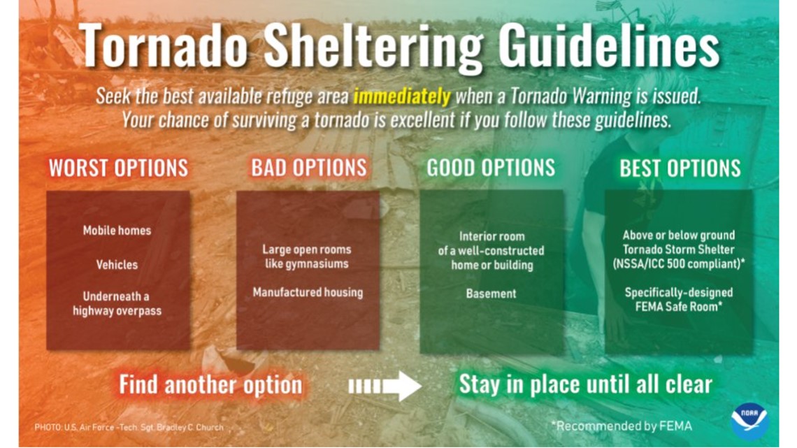
Attached is a helpful guide for you on tornado-safe places! We hope this makes your action plan easier to act out if needed!
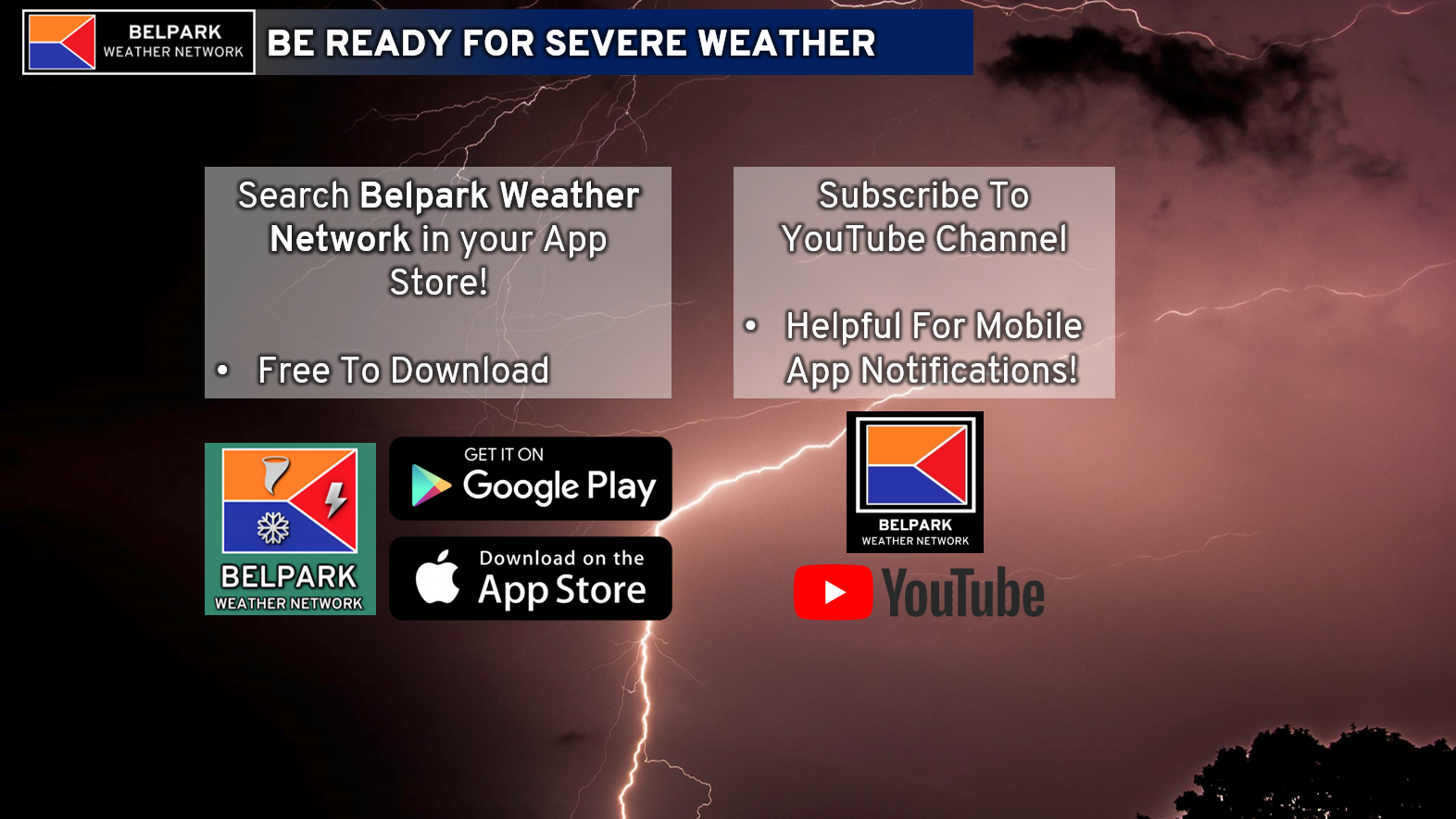
As a final reminder, please be sure you have our Belpark Weather Network mobile app downloaded! It is free on both Apple and Android. Also, be sure to subscribe to us on YouTube so you know when we are live and can watch our team coverage!
1 comment