
Happy Monday everyone! I wanted to take a bit here today to give you an overview of the week ahead and also talk about some record temperatures in the forecast.
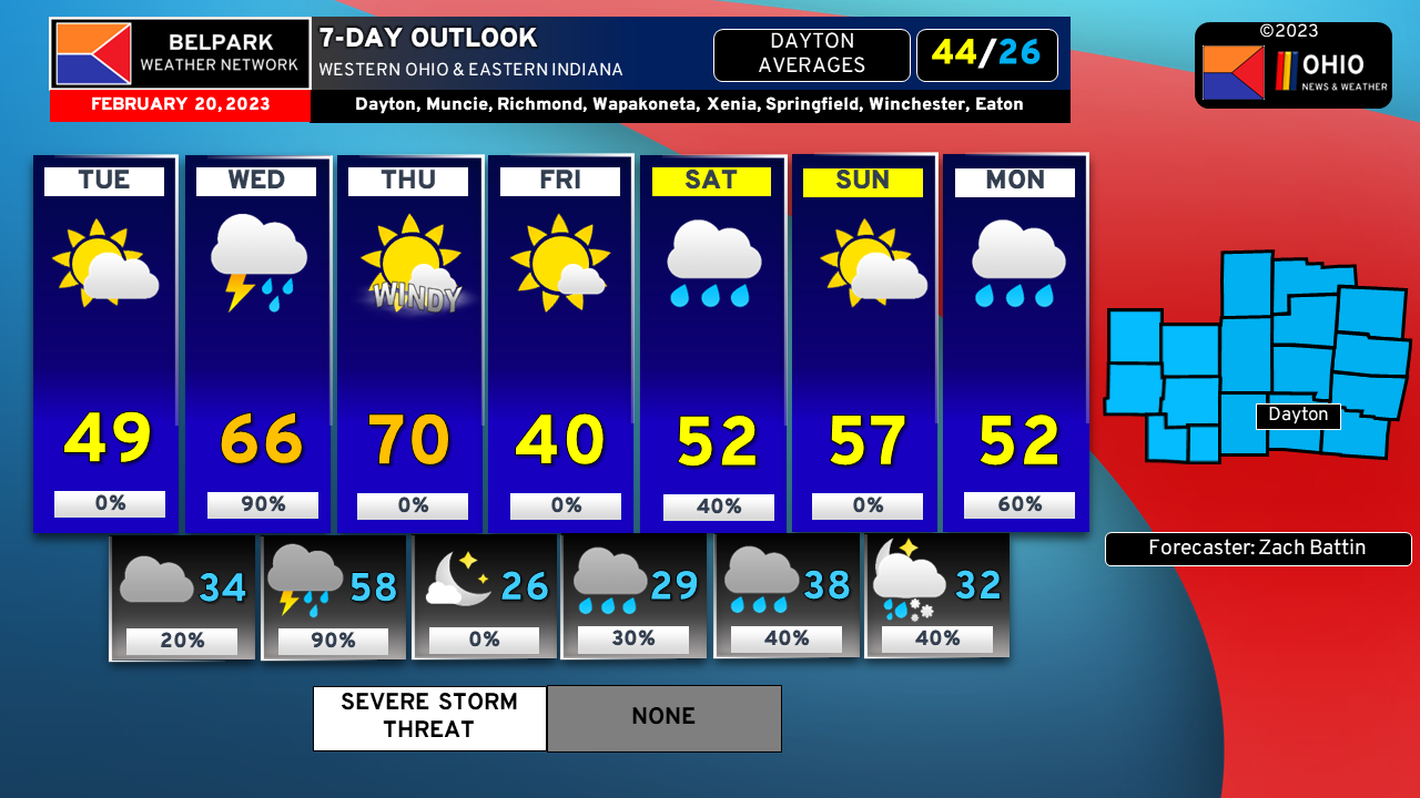
- Tuesday: We are looking at fairly nice weather through the day as well as above normal temperatures. We average right around 44 or so this time of year. Tuesday night may see a passing shower but otherwise mostly cloudy with a low of 34.
- Wednesday: Showers and possibly a rumble of thunder will be possible through the day as temperatures soar toward the mid to upper 60s. The record is 69 so while we will come close, we will likely fall short thanks to the rain that will hang around. Wednesday night will feature showers and maybe a storm or two with a low near 58.
- Thursday: Rain and clouds will move out early in the morning on Thursday allowing for abundant sunshine to build in. With it will come a stiff Southerly to South Westerly wind that will usher in some warm air ahead of an advancing cold front. We could see wind gusts in the 40-50pmh range. The record high is 70 and I will not be shocked if a few spots end up in the low 70s. Once the front passes, temperatures will fall quickly through the evening and we will end up with a low Thursday night around 26. The good news is no precipitation is expected with the front as it moves through.
- Friday: The last day of the work weeks looks calm and much more seasonable with sunshine and a high near 40. Friday night some showers move back in as temperatures drop into the upper 20s.
- Saturday: More showers will be around for your day on Saturday as highs climb into the low 50s, well above average once again. Saturday night will feature some more rain with a low around 38.
- Sunday: The weekend looks to end with some sun and mild temperatures once again, with a high near 57. Sunday night a little bit of rain and snow showers will move in as temperatures drop to right around the freezing mark.
- Monday: Rain hangs around during the day on Monday but some do the above average temperatures. Highs in the low 50s are expected.
That’s a look at your forecast coming up this week! It’ll be active but at least it’ll be warm even if it’s wet at times. Stay tuned to the Belpark Weather Network for the latest forecast and weather discussions as we get the week rolling! Check us out on Facebook, YouTube, and our website!