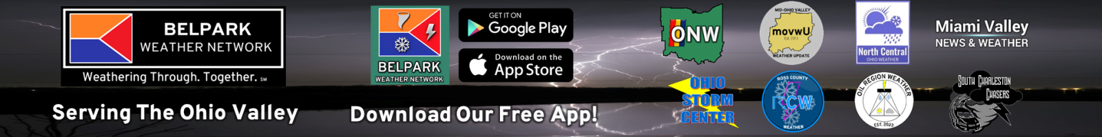
Today was a beautiful day across Northern Indiana and Northwest Ohio. We saw highs in the 50’s with plenty of sun. Tuesday will feature partly cloudy skies with highs in the low 40’s. By Wednesday we see rain move in to the area. I don’t think it will be a complete washout though. Based on the latest data the most widespread rain arrives Wednesday evening.
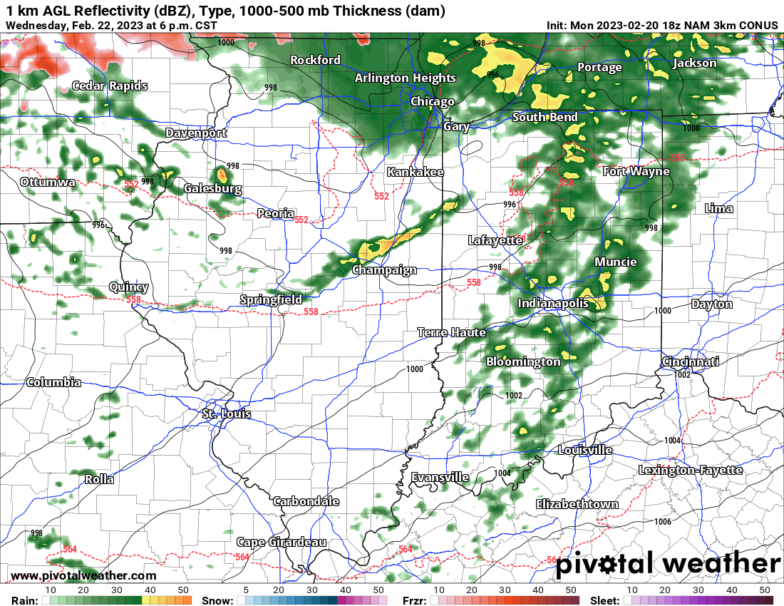
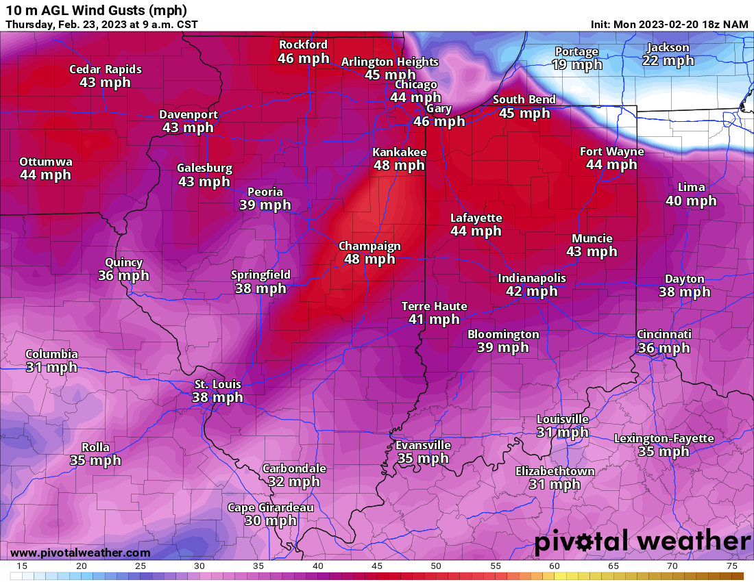
By Thursday things become a bit windy with wind gusts 25-35 mph with higher gusts possible BUT look at the temperatures. Yes those are highs in the 60’s. You can clearly see where the cold front is located. It will likely turn colder as the day goes on Thursday. By Friday we’ll briefly see highs in the low 30’s before we rebound nicely for your Saturday with highs Saturday in the mid 40’s.
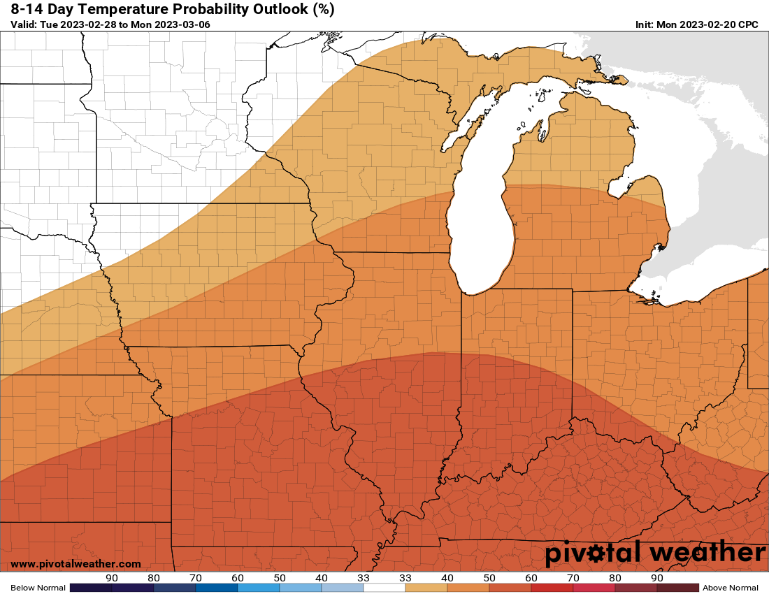
ABOVE AVERAGE WARMTH CONTINUES: A look at the 8-14 day temperature outlook from the Climate Prediction Center and we see that continued trend of above average warmth. We are also gonna see some above average precipitation as well as the projected 7 day rainfall totals look to be between 1.5 and 2 inches.
I truly hope all of you have a wonderful Monday night. We’ll catch up with yall tomorrow.
1 comment