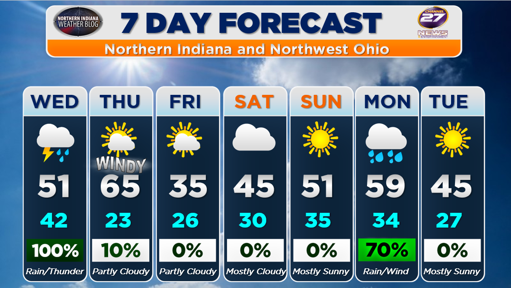
Here’s a look at your 7 Day Forecast along with our 5 Day UV Forecast. More of the same up and down weather we’ve been dealing with. Above average warmth remains a common theme with no prolonged cold weather in sight. As we head into Wednesday we do get some needed rain BUT we may get some minor flooding issues to go with it.
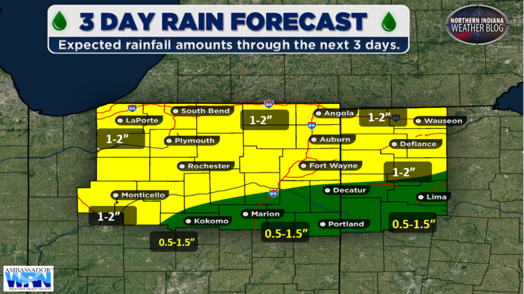
Here’s a look at our expected rainfall over the next 72 hours. The heaviest rain is expected to fall north of Fort Wayne and this could lead to some minor river flooding. That risk is greatest from Fort Wayne and points north.
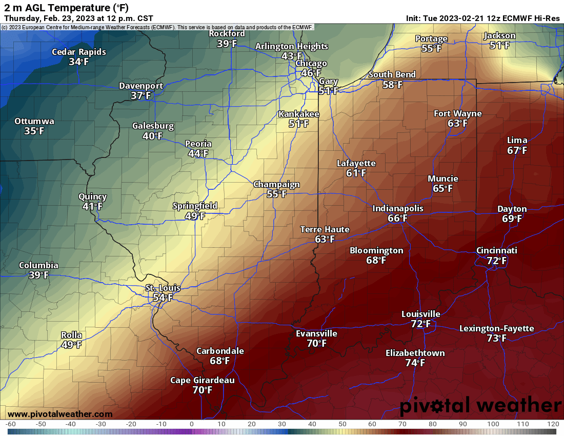
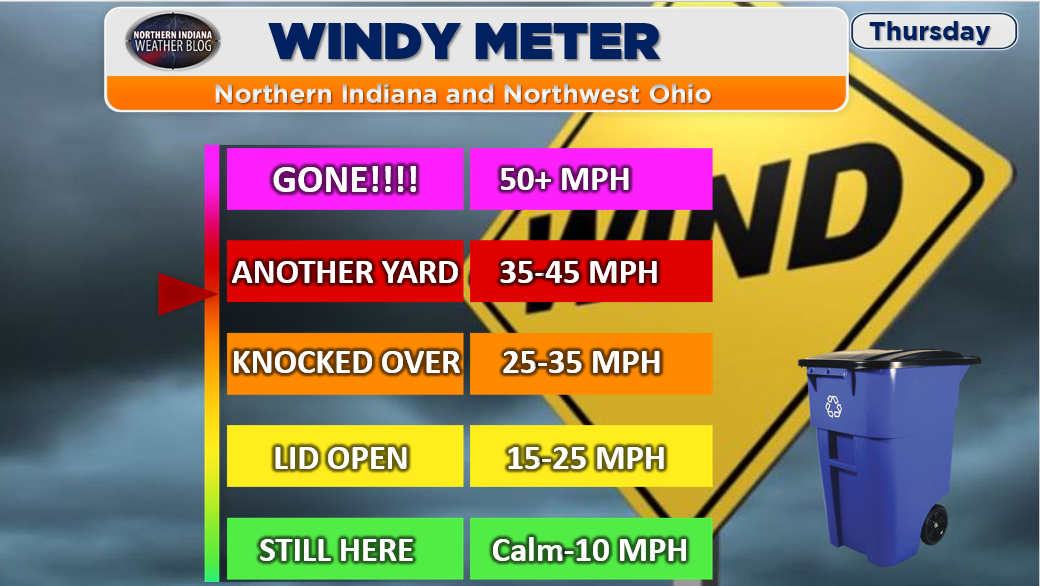
WARM AND WINDY THURSDAY: Thursday will be quite warm with highs in the mid to upper 60’s and it will be on the windy side with winds 25-35 mph with gusts as high as 45 mph possible. We’ve reflected that in our Windy Meter down below.
With all of the above in mind how are you enjoying the lack of snow and warmer weather??? Has spring fever set in already??? Let me know in the comments below. I hope all of you have a wonderful Tuesday night.