
February 19, 2023
Written by: Nick Dunn
Columbus, OH (Belpark Weather Network) — Hello, everyone! I hope you have had a great weekend so far. Friday was certainly chilly with those snow showers. Saturday was a bit better, and today will turn out to be the warmest of the weekend. Highs remain at least 10 degrees above average for this time of year, which is remarkable!
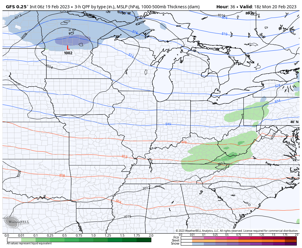
So, what does the upcoming week have in store? We will start out mainly dry aside from some light rain showers possibly on Monday. The overall coverage will not be great and our drier air mass should keep any rain activity limited in duration, too.
We could also see a few spotty showers north of I-70 on Tuesday, but models are not in great agreement with that potential. Our eyes will start to turn to a developing storm system that will eject out of the Rockies and move into the Central Plains. This storm could drop over 12″ of snow across the northern Plains as cold air will be in place for precipitation to fall as snow.
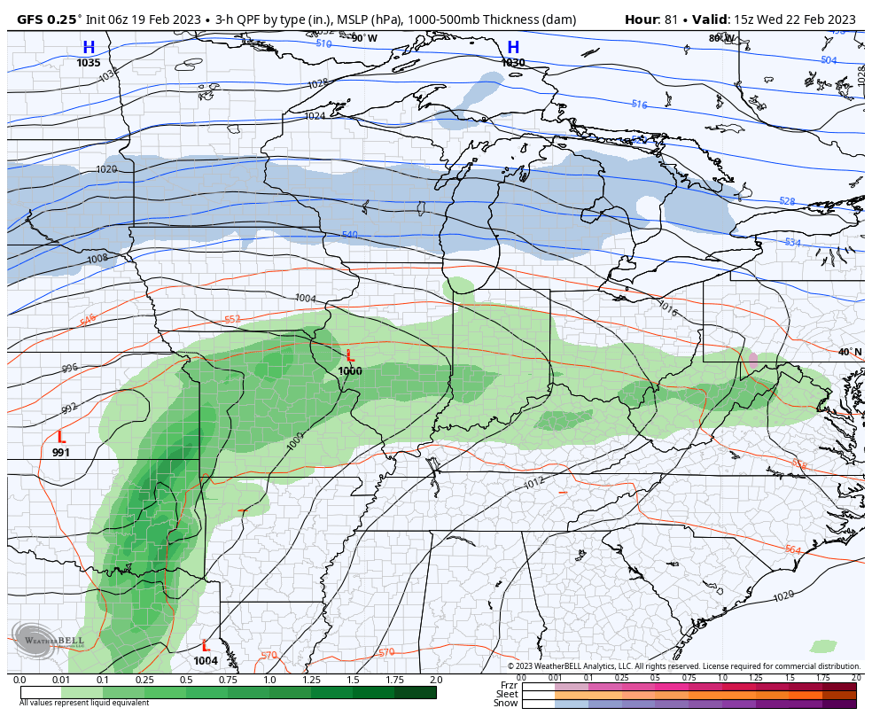
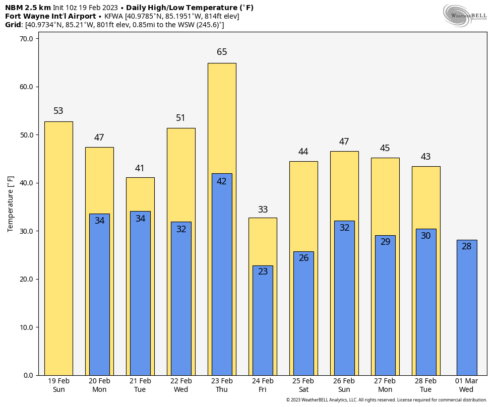
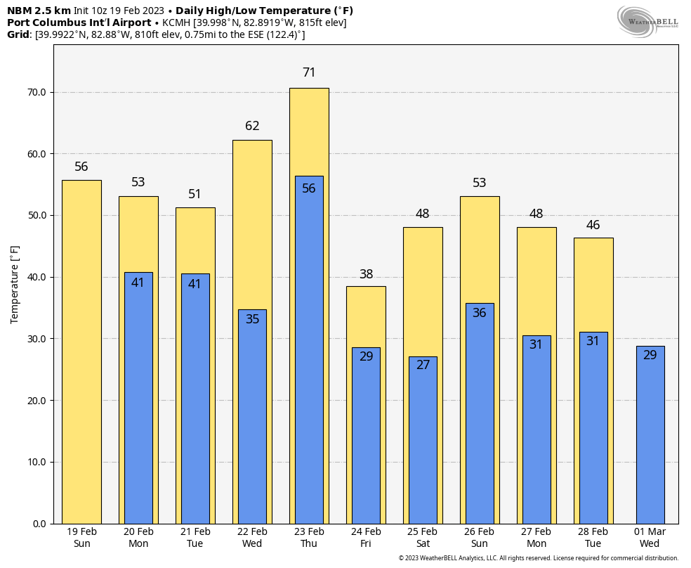
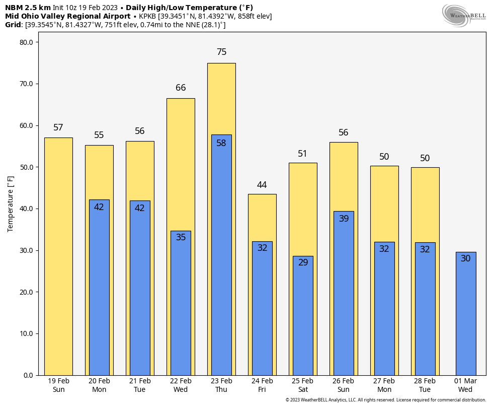
By Wednesday, widespread rain starts to develop and will overspread the region during the afternoon and evening. We will remain mild with highs in the 50s for most. Across northern Indiana and northwest Ohio, we will have to watch temperatures as some models suggest some wintry precipitation trying to move into the region. Just like last week, 25-50 miles makes a big difference in what we will see.
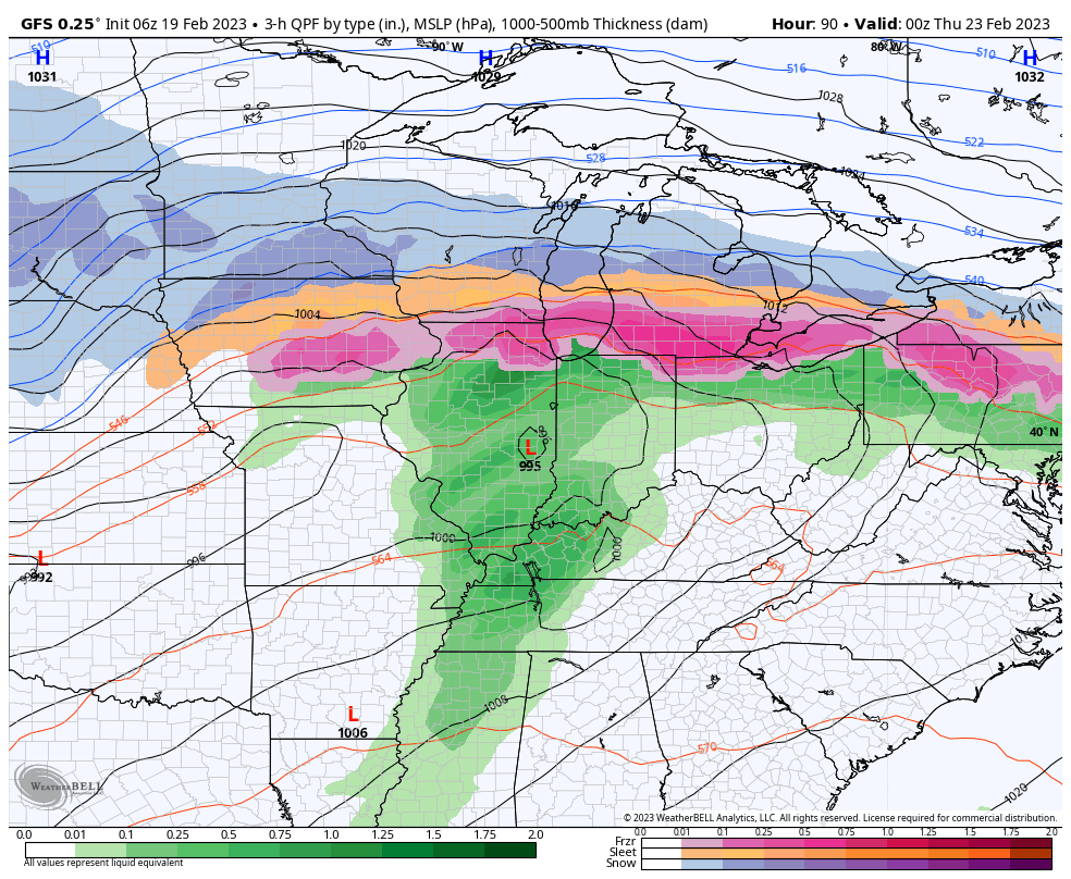
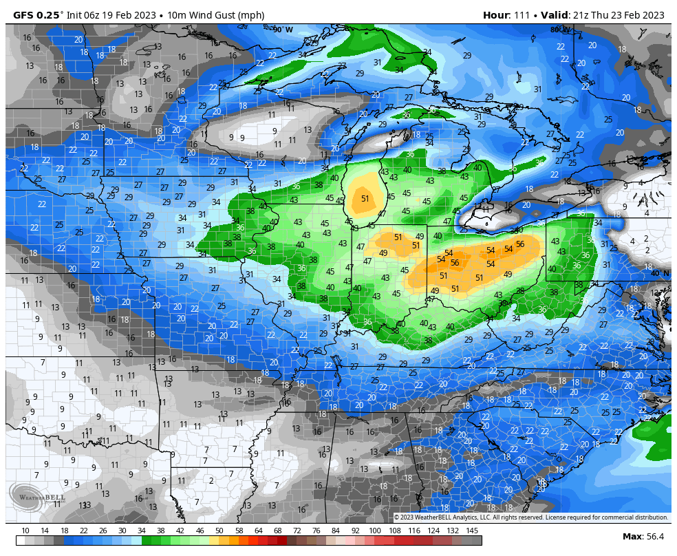
With the area of low pressure centered in Illinois, there certainly could be some mixed precipitation or freezing rain north of US-30 across northern Indiana and northern Ohio. We will have to see how far north the warm air makes it. Check out the bands of snow across the northern Plains to the upper Great Lakes! South of US-30 here locally, mild temperatures will continue with rain showers. In fact, lows Wednesday night may not fall much out of the 50s.
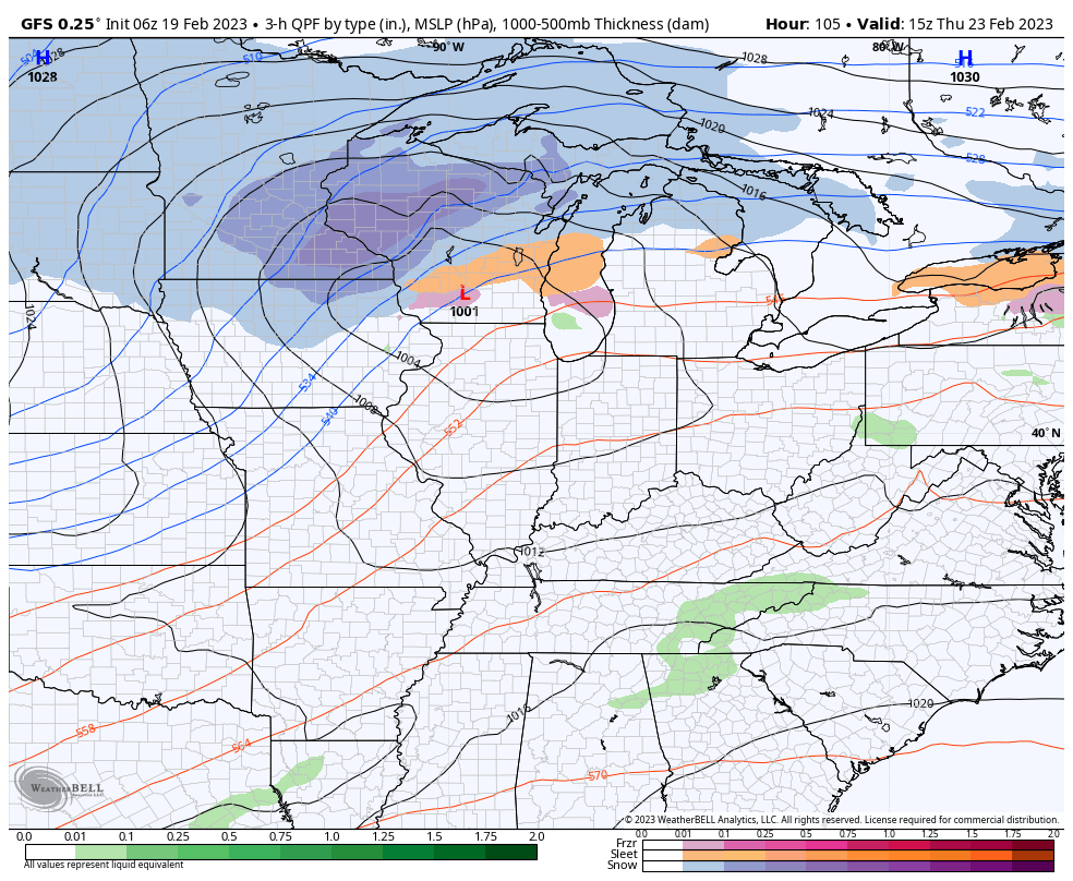
By Thursday, a secondary wave of low pressure moves into the western Great Lakes and keeps the snow machine going across the upper Great Lakes to the northern Plains. Locally, we will see a very warm day again on Thursday, marking a recent trend of Thursday being warm. Highs will be in the 60s and even 70s for most across the Belpark area ahead of a cold front. In addition, gusty winds over 40-50 MPH are possible based on the latest guidance. Sure has felt like a windy month, right?
Behind this system on Friday, temperatures will trend colder and may turn below normal for one day before next weekend we see another moderation in temperatures. Our roller coaster ride in temperatures is very evident in some of the model guidance as well!
I hope all of you have a great week! Be sure to stay tuned for updates with us on Facebook!
– Nick Dunn, Belpark Weather Network Forecaster