The next big winter storm is on the way Friday and Saturday and with it comes a wintry mess of rain and snow. Behind it, much colder air will move into the region and this will be reinforced by strong high pressure early next week, bringing the coldest air we have seen so far this winter. Let’s dive a little deeper.
The System
A deepening low pressure system will move out of the Central Plains and into the Lower Ohio and Wabash River valleys. This system will then track northeastward across Indiana and into Lower Michigan Friday night and into the day on Saturday. At this point, models differ with the track as some are a little further west and east. These slight variations have major implications on exactly where the heavier snow will fall. On Saturday, the low continues to pull northeastward and wrap around moisture and cold air will continue to generate snowfall into Saturday evening across portions of the area. Lake effect snowfall is expected into the day on Sunday for areas east of Cleveland, OH and should begin to shut down sometime Sunday afternoon as cold, Arctic high pressure works into the area.
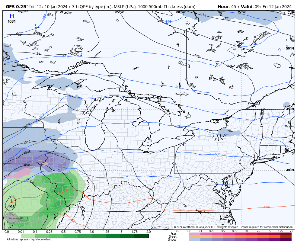
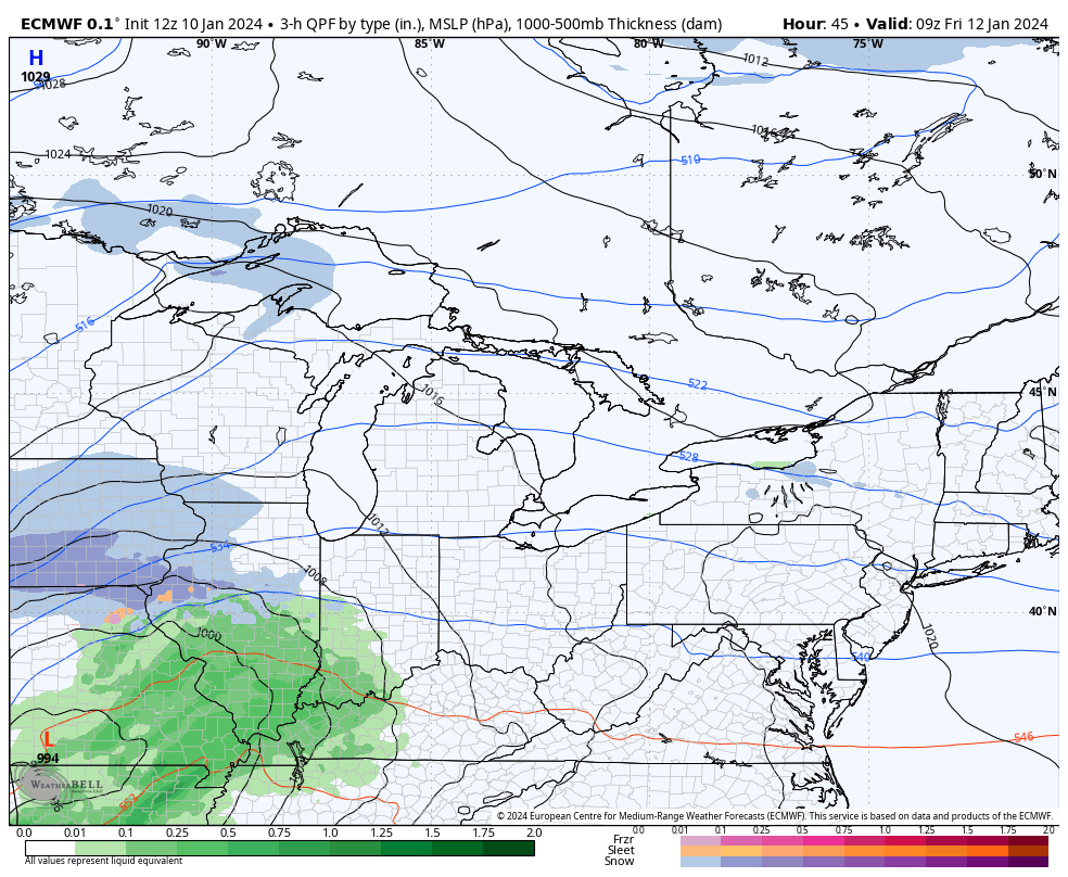
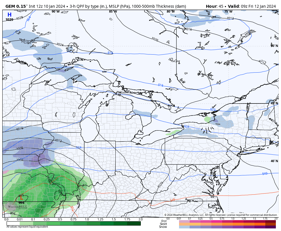
The Models
Latest Thoughts & Snowfall Forecast
The models haven’t quite come together on this system. Each long range model above has it’s operational run (which is shown) and a set of ensembles. The number of ensembles a model has varies and each one takes various parameters differently. Each ensemble then produces a mean and so far, each models ensemble run hasn’t quite agreed with the operational outputs (or vice versa). This creates issues with forecasting as we are well aware the tracks of these systems will likely shift over the next 24-36 hours. Which way it shifts (further west or east) is paramount to where the heavier snow falls.
Our latest snowfall forecast:
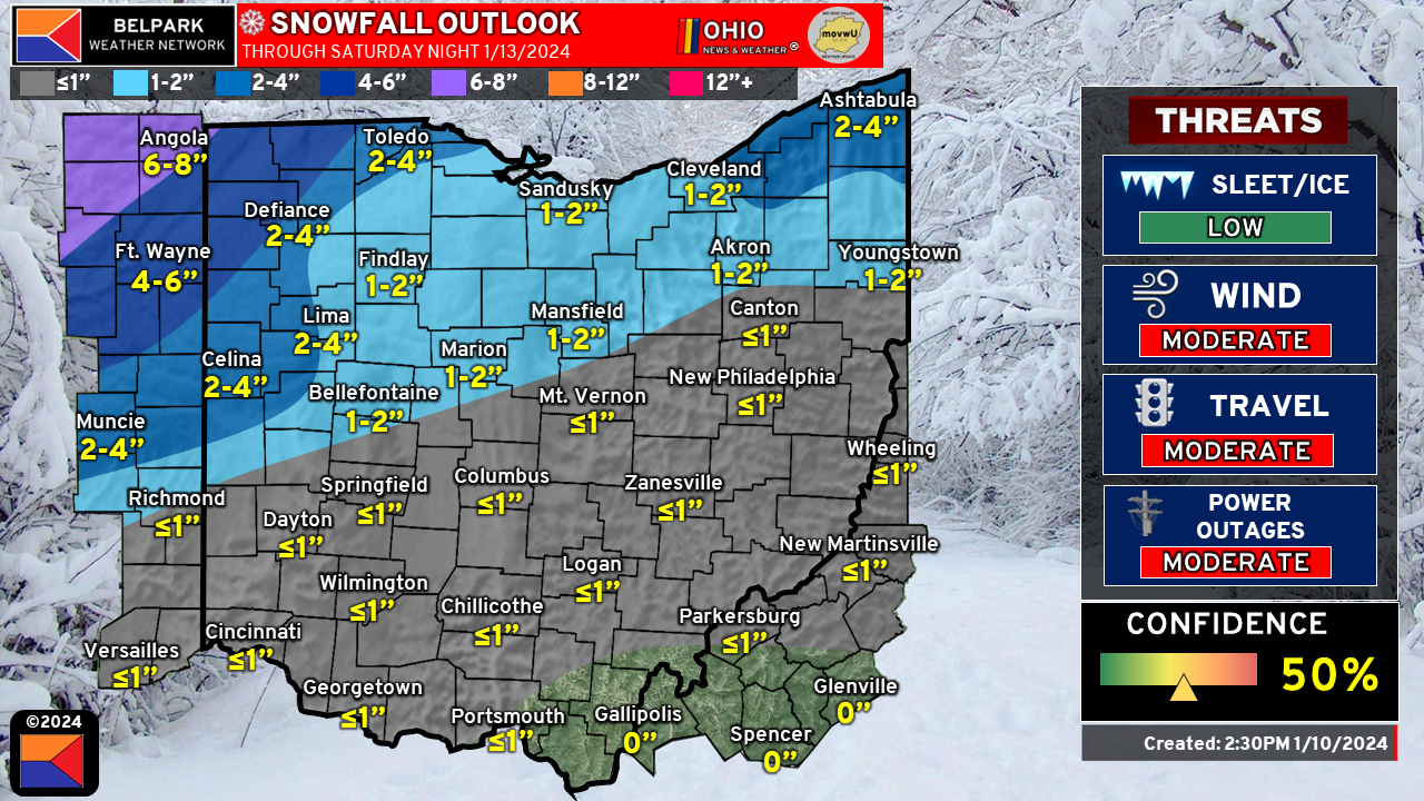
The heaviest snow for the area will be across Northeastern Indiana and Northwestern Ohio. Any shift in track greatly impacts the forecast in this area. Elsewhere, snowfall amounts will be minor.
For Northeastern Ohio, lake effect snowfall will be ongoing through at least Sunday morning before shutting down. There does seem to be a period of time where we will likely see a connection from Lake Michigan set up and bring additional moisture into the area. While our 2-4″ forecast is primarily for the system snowfall and early lake effect/enhanced snow Saturday evening, areas across Northeast Ohio, generally in the primary snowbelt, will likely see snowfall totals exceed 6″ by the time the snow ends. Where exactly this falls is still a little uncertain. There is a decent probability however, of 6-8″ of snow for portions of southern Lake and Northern Geauga counties.
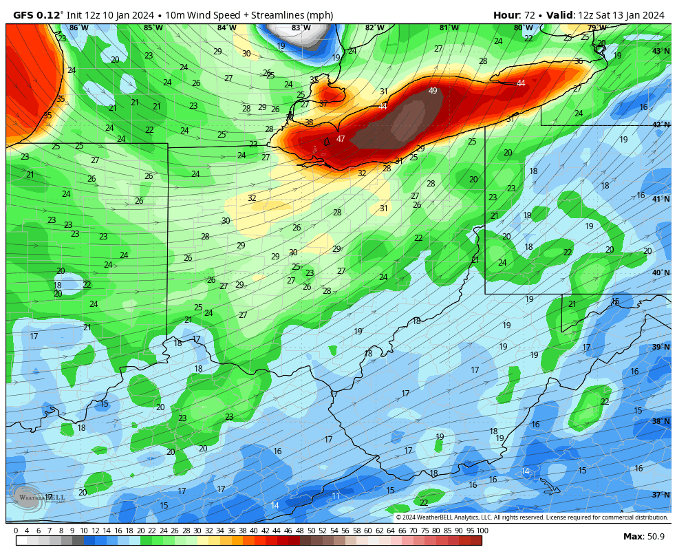
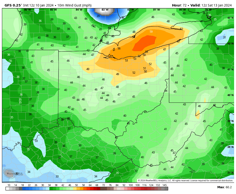
Getting Windy!
Winds will be quite strong too. By Saturday morning, sustained winds from the southwest will be on the order of 25-35 MPH with wind gusts near/over 50 MPH.
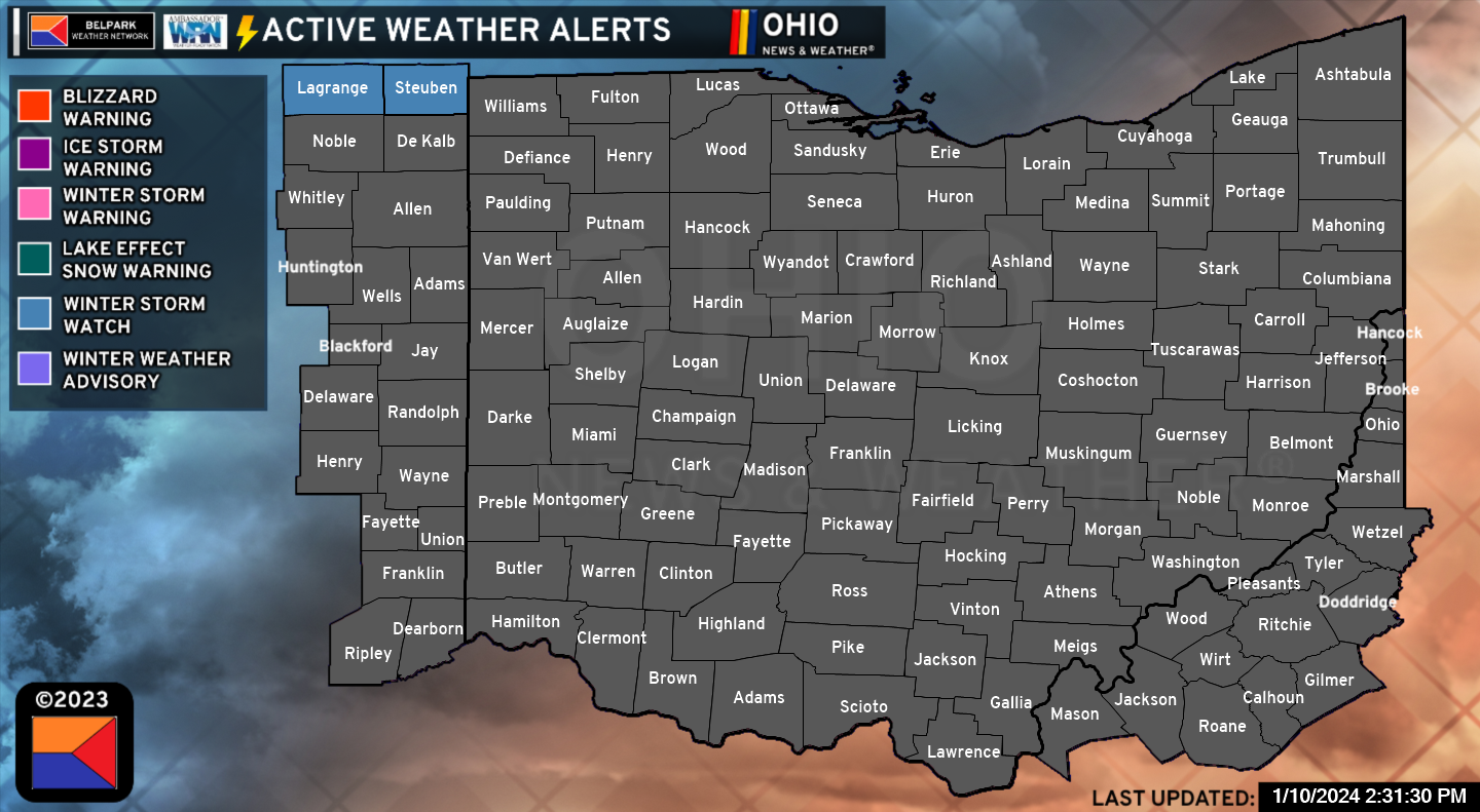
Latest Advisories
Here Comes The Cold!
By early next week, we are tracking another potential storm system that may bring snow to the area Monday night and Tuesday however models really differ on how this system comes together. For now, this is something we will continue to monitor.
Temperatures get into the “stupid cold” range Monday night and Tuesday and could remain there for at least a few days. Consider these Tuesday morning temperatures:
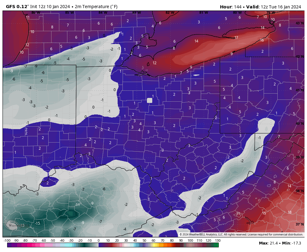
Wind chills will be quite cold and at least 8-10 degrees below the depicted air temperature. If you haven’t already, dig out the super warm weather gear!
Be sure to stay with Ohio News and Weather for the latest weather information and download our app!