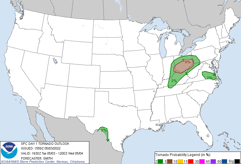
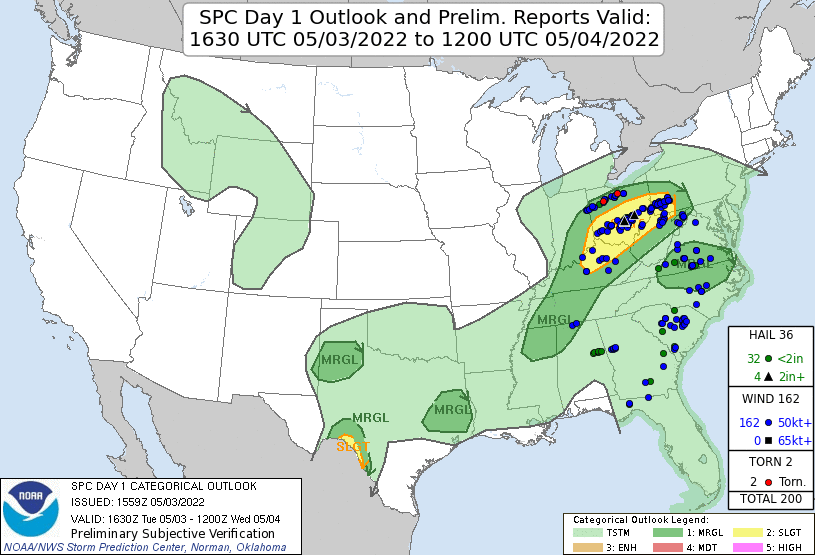
Tornado Reports: 2
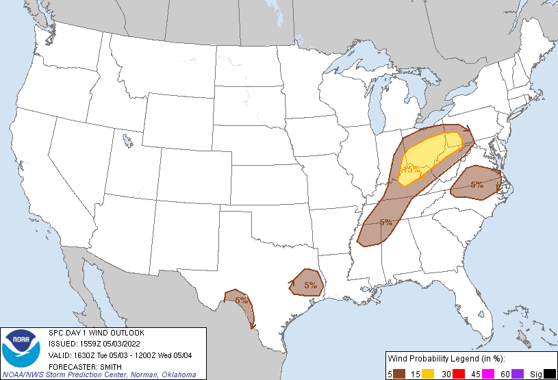
Wind Reports: 45
Hail Reports: 17 (4 2+ inches in diameter)
Some images sourced from https://www.spc.noaa.gov
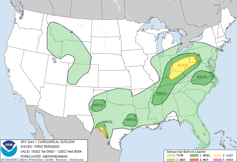
Day 1 Outlook
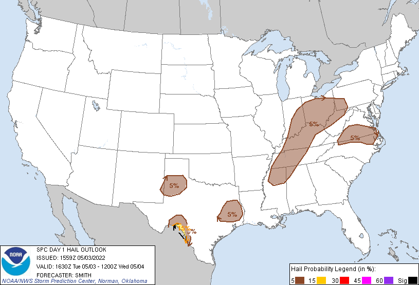
On Tuesday May 3rd, the threat of severe storms returned to the Ohio Valley, bringing with it the threat for damaging winds, large hail, and a few tornadoes. As is typical for events in the Ohio Valley, they day started with with rain across most of the state, keeping temperatures down through the morning. By afternoon, clouds began to break in SW and Central Ohio as a low pressure system crossed Northern Indiana. The approach of the low pressure allowed more moisture to move North deeper into Ohio, at the same time temperatures began to warm thanks to the breaks in the clouds. With a close proximity to the Low pressure, ample shear (mainly speed shear) was in place across most of Southern Ohio.
By 1:30pm, storms began to fire in SE Indiana and SW Ohio.
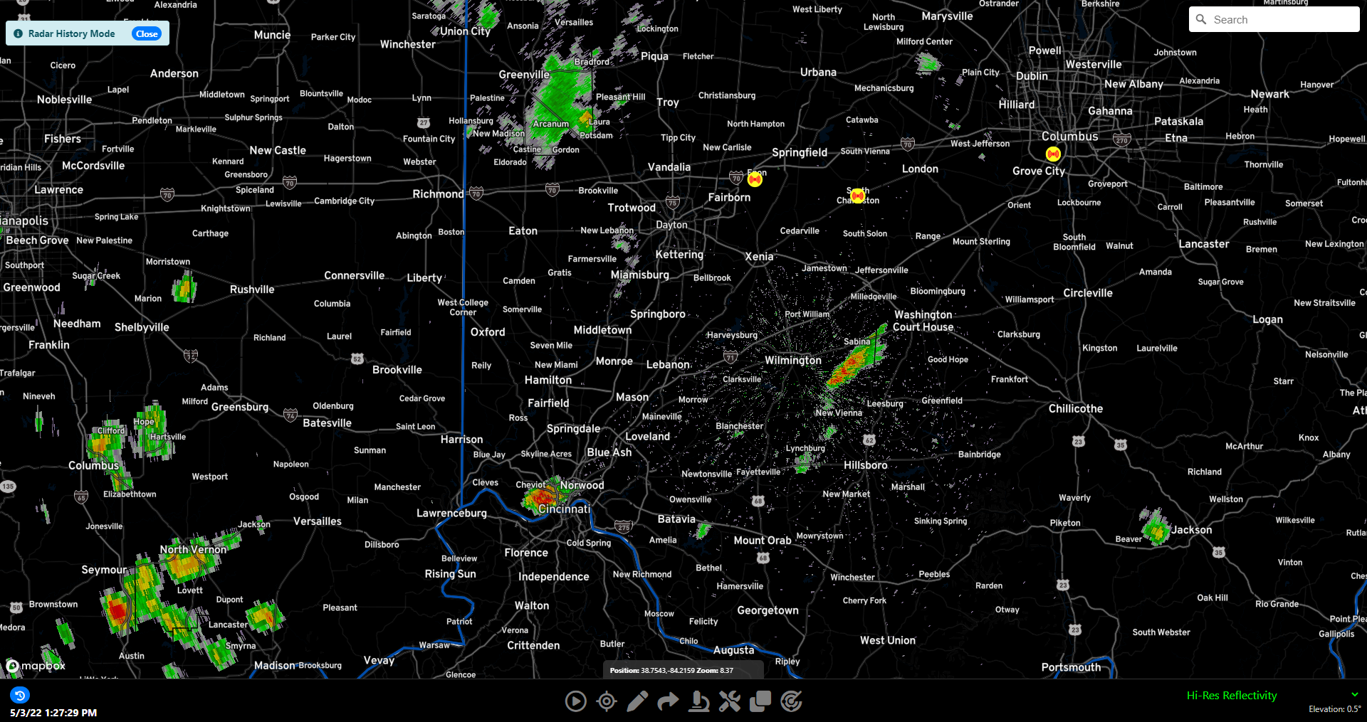
At 1:57pm, a storm near Washington Court House had shown considerable strengthening, and our first thunderstorm warning was issued.
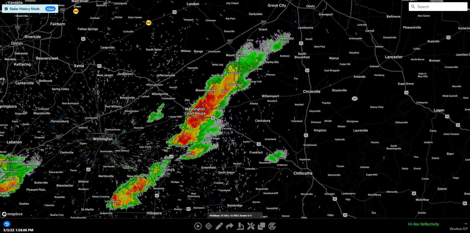
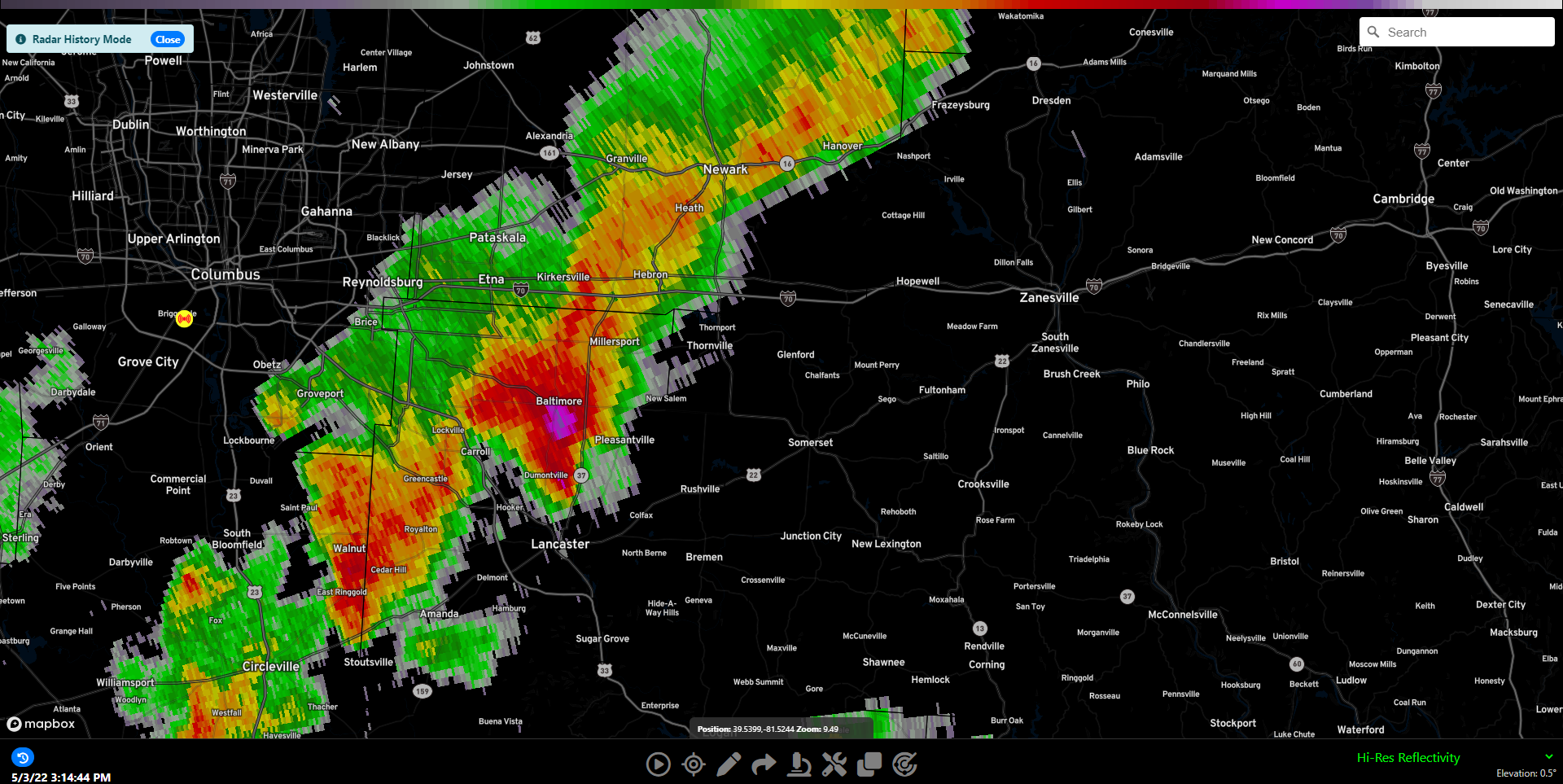
This first storm would continue on for some time, producing large hail near Lancaster and Zanesville, and strong winds along the way.
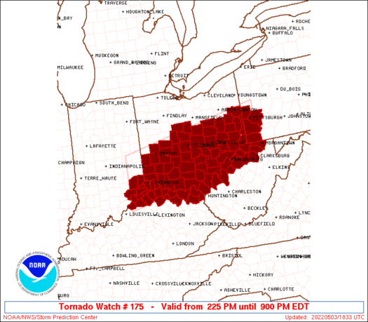
At 2:45pm, a tornado watch for a large chunk of Ohio was issued. This would later be expanded North to cover a storm complex moving across Northern Ohio.
While most of Southern Ohio and the Mid Ohio Valley was dealing with severe storms with wind and hail, a new complex of storms was forming in Eastern Indiana.
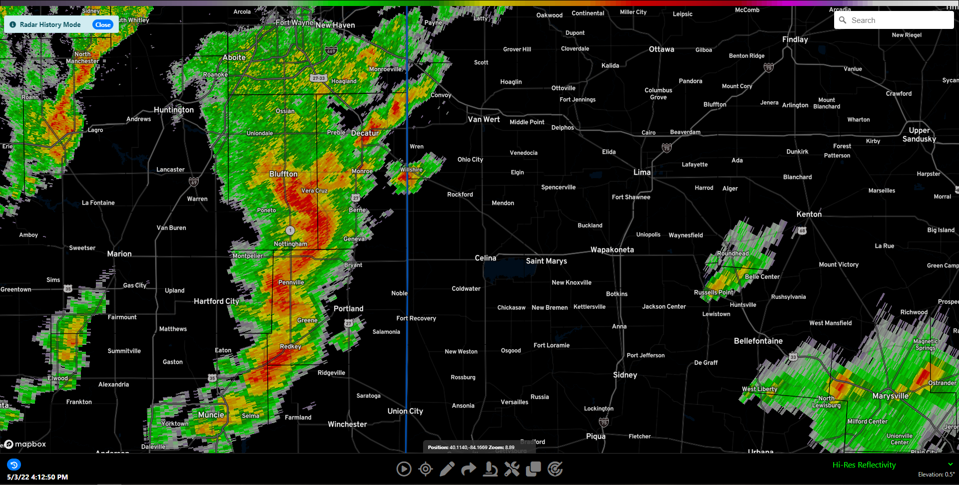
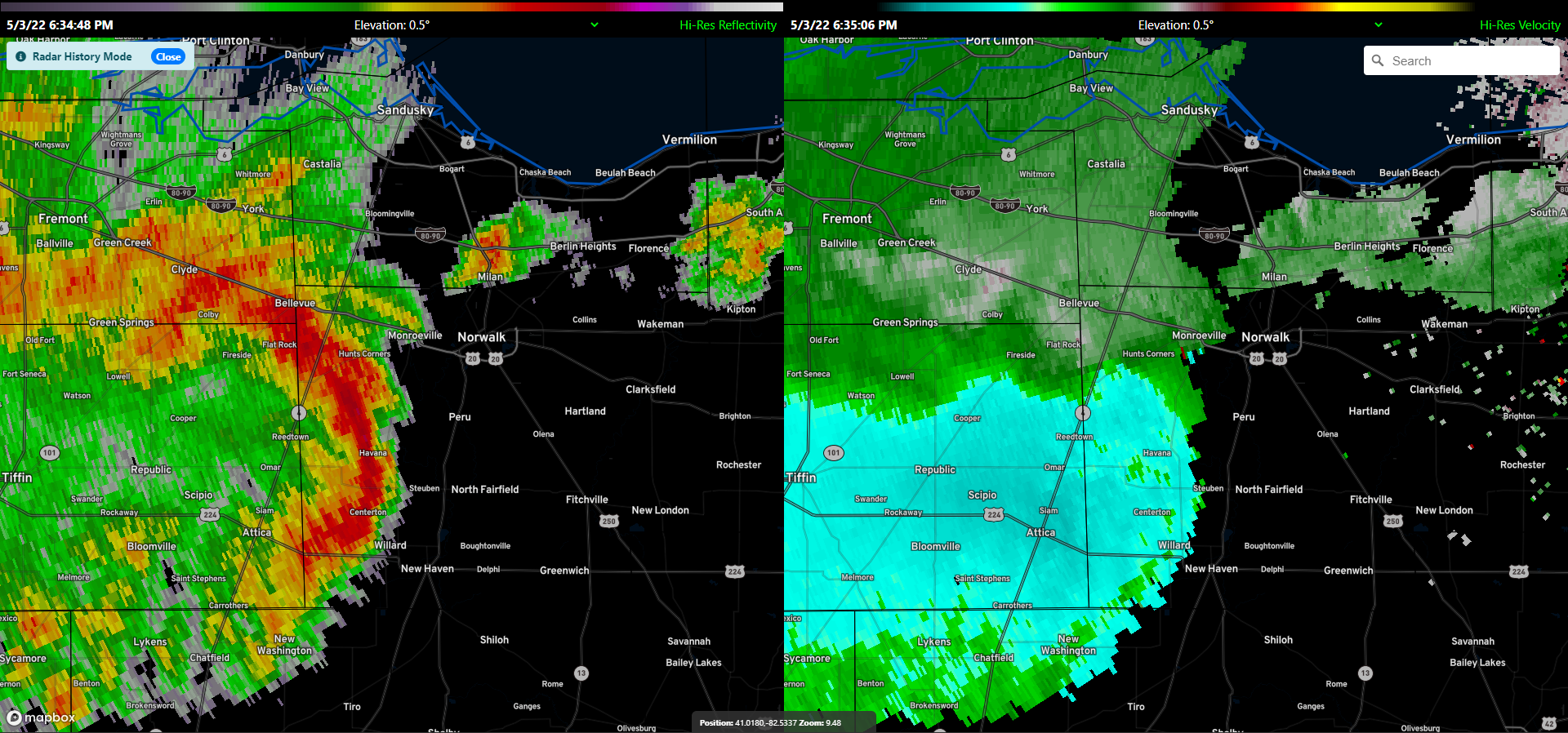
This complex of storms would race NE into Ohio, eventually prompting the first tornado warning of the day.
This storm would continue moving off to the East and slightly North, showing rotation as well as an increasing threat for damaging winds and large hail. As the storm approached the Norwalk area, the tornado threat had mostly diminished and a straight line wind threat became the main concern with the bowing structure.
At 7:10pm a new Tornado warning was issued near Lagrange, Ohio as the storm attempted to spin up once again.
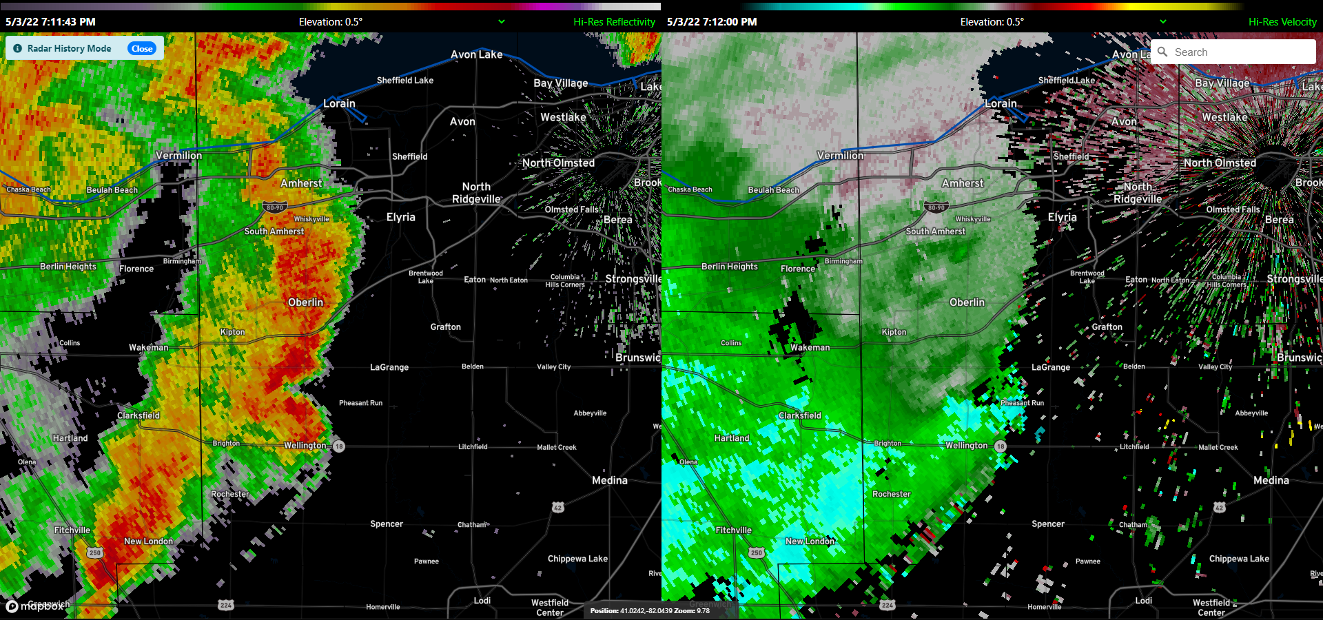
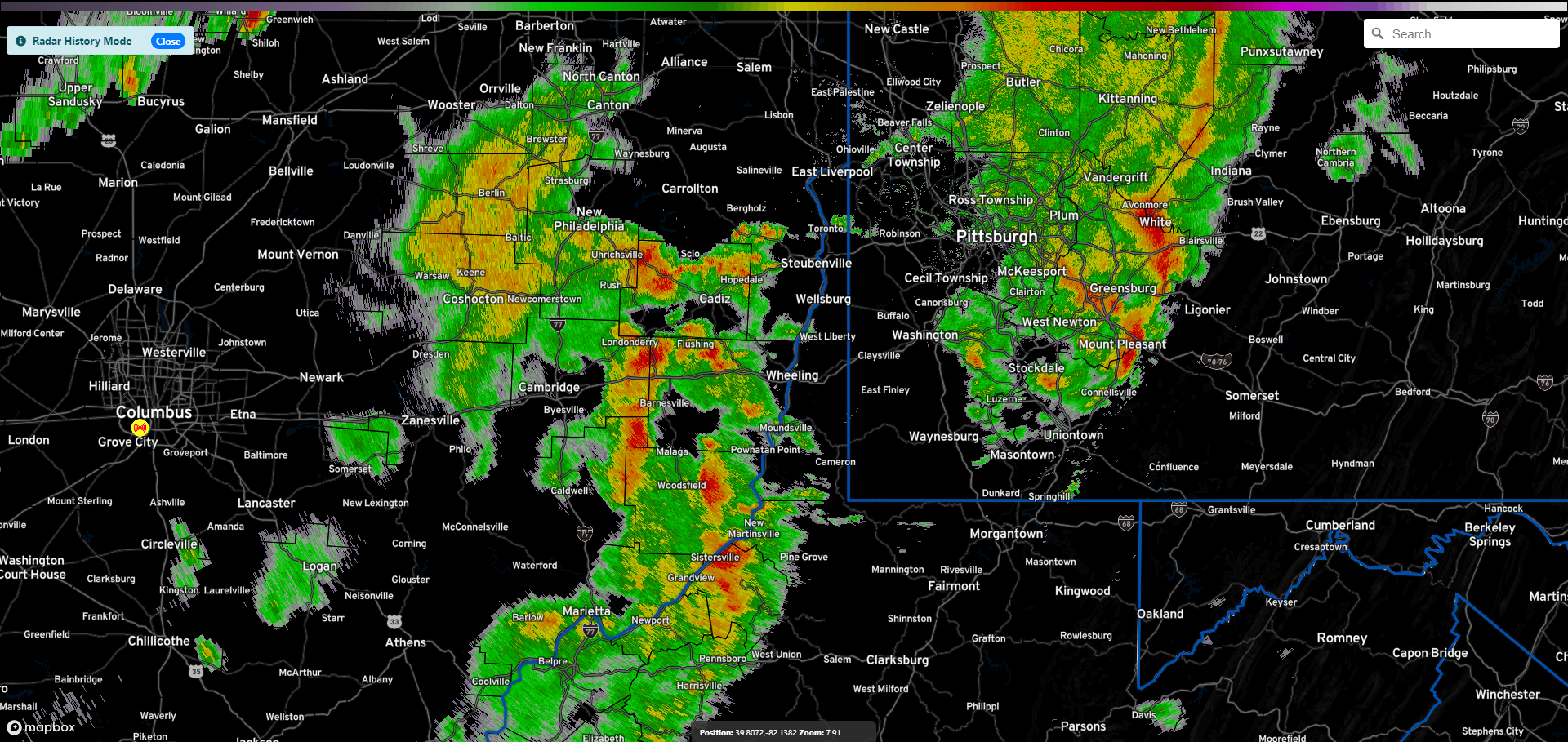
Shortly after this storm would weaken and die off and most of the region would be left with heavy rain and non severe wind gusts. Elsewhere during this time, Eastern Ohio was dealing with the few remaining strong storms in the area.
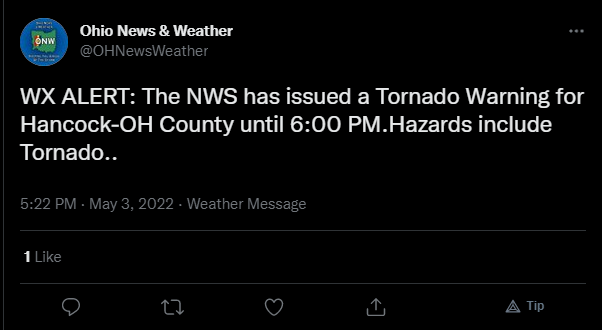
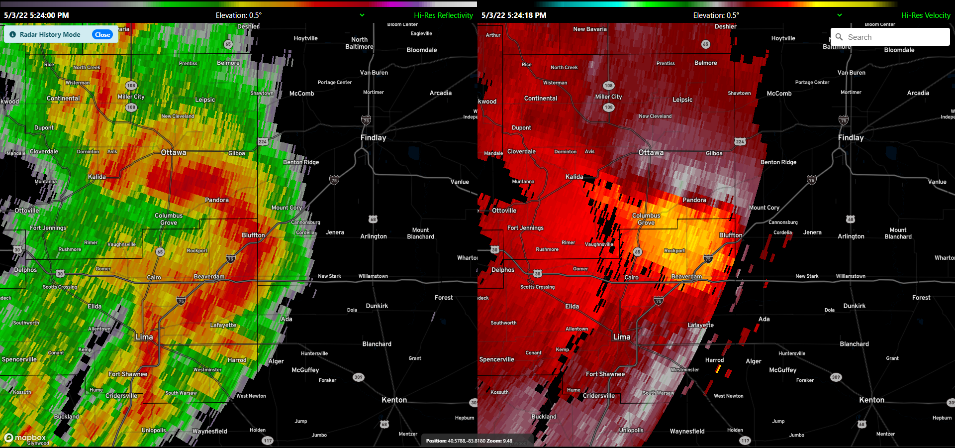
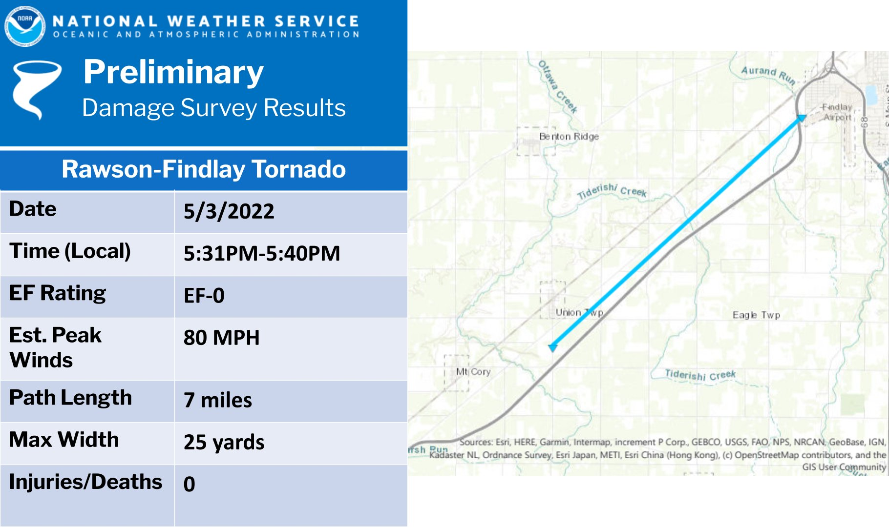
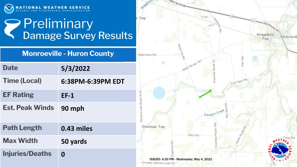
The National Weather Service in Cleveland sent teams out to Hancock and surrounding counties to look over damage reports and determine if any of it was caused by a tornado. They determined that an EF-0 Touched down near Findlay in Hancock County, and an Ef-1 near Monroeville in Huron County.
- Tornado Reports: 2
- Wind Reports: 45
- Hail Reports: 17 (4 2+ inches in diameter)