February 18, 2023
Columbus, OH (ONW) — We have been stuck on repeat lately in terms of the overall weather pattern. We have mild temperatures during the early portions of the weekend, wet and windy weather during the middle portions of the week, and colder ends to the week.
We have been facing a lack of snow recently, with all of our region remaining below average for the entire Winter Season. So, where is the snow?

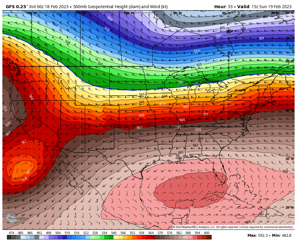
Taking a look at the 500mb model image above, we are largely in a milder pattern for right now, with no arctic air able to plunge into the region as high pressure controls the region. The colder temperatures are locked up well into Canada, with no real sign of frigid air intruding the region. This also sets up a pattern where disturbances will track north of the region along the orientation of the jet stream. The “lower” the Heights (Blue/Purple), the colder the temperatures will be. The “higher” the heights (Red/Salmon Colors), the warmer the temperatures will be.

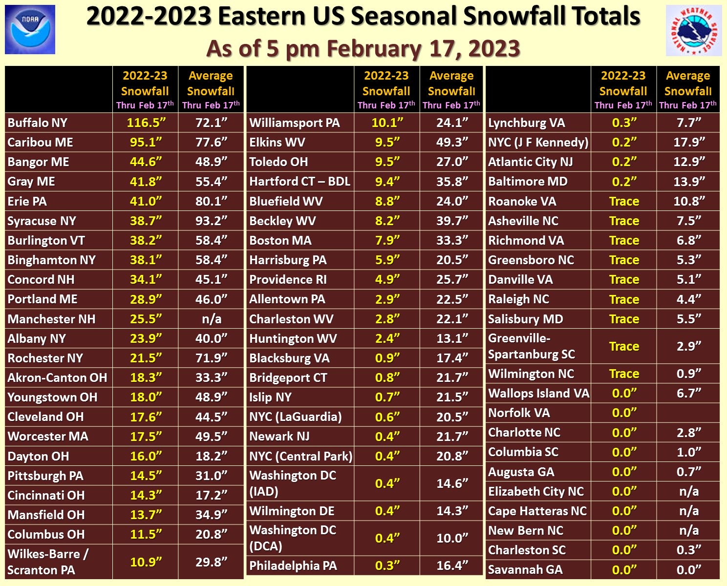
Checking out our snowfall totals across the eastern United States, we see that many locations are running well below normal for this time of the Winter season. Youngstown is almost 31″ BELOW normal on snowfall. Some of our West Virginia counties have yet to even see 5 inches of snow. Compare that to Buffalo, which has had over 100″ of snow this Winter!
Let’s remember that we have had snow well into early Spring. However, it is looking more and more likely we will wind up below normal on snowfall for the season.

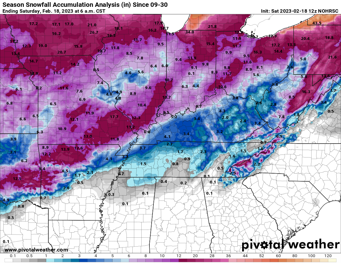
Above is an Estimated total for snowfall this season, which clearly shows the track of storms has resulted in a lack of snow, and even lake effect snows have not been as heavy compared to what normal snowfall would show.
Unfortunately, we have no snow in the near future. In fact, multiple rain chances will return next week, along with continued Early-Spring temperatures!
