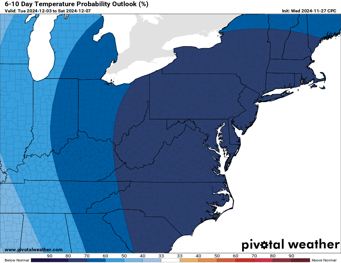
Meteorological Winter starts December 1st and we’re going to enter it with a bang! Unseasonably cold air will stream into the eastern portion of the United States, allowing for lake effect snow to develop and persist for several days. Significant accumulations are quite possible.
A Winter Storm Watch is currently in effect for Ashtabula and Lake Counties from late Thursday night through Monday night.

The Setup
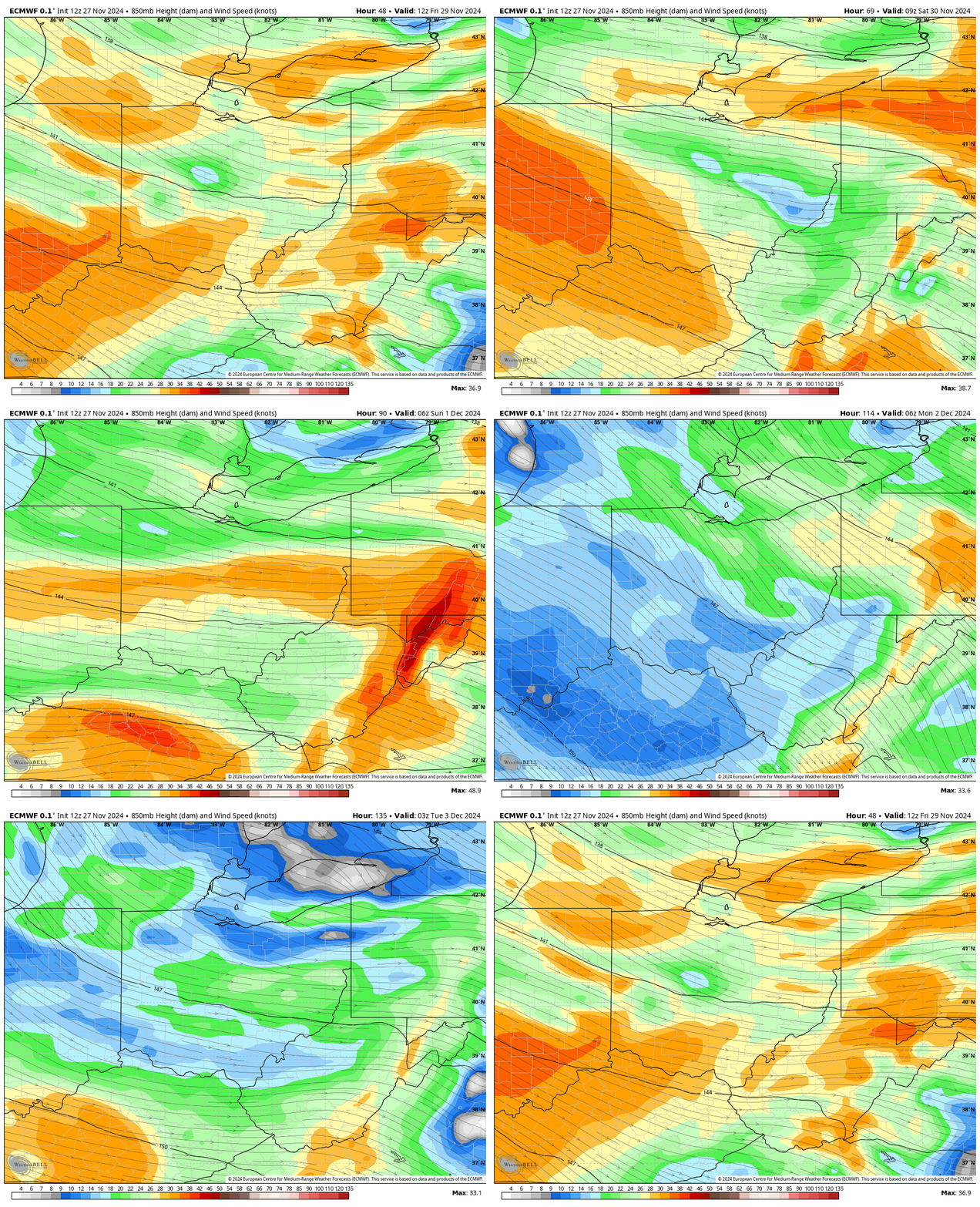
A West and eventually Northwest flow across the Great Lakes will help kick up lake effect snow starting early Friday morning (before sunrise) and persist for several days, possibly until Tuesday (or even later). Combined with the cold air in place, high snowfall ratios can be expected on the order of about 15:1 on average throughout the event.
Winds early on will be westerly aloft and will likely be able to tap into moisture streaming from Lake Michigan. By Sunday, winds become more Northwesterly, which could allow for a fetch to come from portions of Lake Huron. This will all aid in enhancing the lake effect snowfall with plenty of moisture already available across an ice free, and still relatively warn, Lake Erie.

Winds at the surface will be from the west southwest, which could aid in steering the lake effect bands at times. This may push more of the snow over the lake and into Northwestern Pennsylvania, at least for a time. Over time, winds become more westerly, favoring snow in the primary snowbelt. Winds will generallyvary between 10-20 MPH with higher gusts possible at times. This will create near whiteout conditions, especially in any heavy snow bands.
Temperatures won’t be super cold but will be cold enough and certainly below average for this time of year. For much of the event, temperatures will average in the mid to upper 20s. Combined with the winds, wind chills will range in the low to middle teens. As you head outside to shovel or move snow, be sure to bundle up and dress in layers.
How Much Snow?
This is a significant snowfall event. As such, these come with some uncertainties, such as:
- Duration of the event
- Placement of snowbands
- Intensity
- Winds (direction and speed)
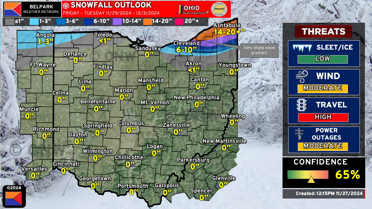
Our forecast only goes through Tuesday, and it is possible that the event could persist beyond that. There is enough energy for potent snow bands with 2 inch per hour snowfall rates (or better) possible. The biggest caveat is where the snow bands set up. Models have been in decent agreement on a more classic lake effect setup with snow from Eastern Cuyahoga County eastward into southern Lake, Geauga, and portions of Ashtabula counties getting the heaviest snowfall.
The snowfall gradient will be ridiculously sharp. Big differences in snowfall across short distances will be noted. Also keep in mind that snowfall amounts will vary and our forecast will likely change over the next couple of days.
Further west, some lake effect snow is possible off of Lake Michigan into portions of Northeastern Indiana and far Northwestern Ohio. Amounts here will be much lighter, generally in the 1-3″ range.
Here is our latest snowfall forecast:

We will continue to monitor the latest model data and update this map as needed. With Thanksgiving coming tomorrow, we will probably not update this again until Friday morning. This allows for a couple of things to happen:
- Cold air begins to arrive
- Winds begin to align
- Snow bands begin to set up
Very Poor Travel Conditions
If you are traveling I-90 between Cleveland, OH and Buffalo, NY, be prepared for very poor travel conditions. Snow covered roadways, low visibility and heavy snowfall will cause significant travel delays. It may be best to delay travel if at all possible. If you must travel, allow for plenty of extra travel time, bring supplies to stay warm, bring non-perishable food items and other items such as a shovel, cat litter, ice melt, etc. in the event you become stranded.
Please stay tuned to our social media pages for the latest updates!
