Written by: Zach Battin & Nick Dunn
Hello, everyone and happy Friday! It has been a mostly dry week with very warm temperatures! We certainly could use some rainfall across the region. As we look back at the month of May, some places had a nearly 3 inch deficit, while some had less than 1 inch.
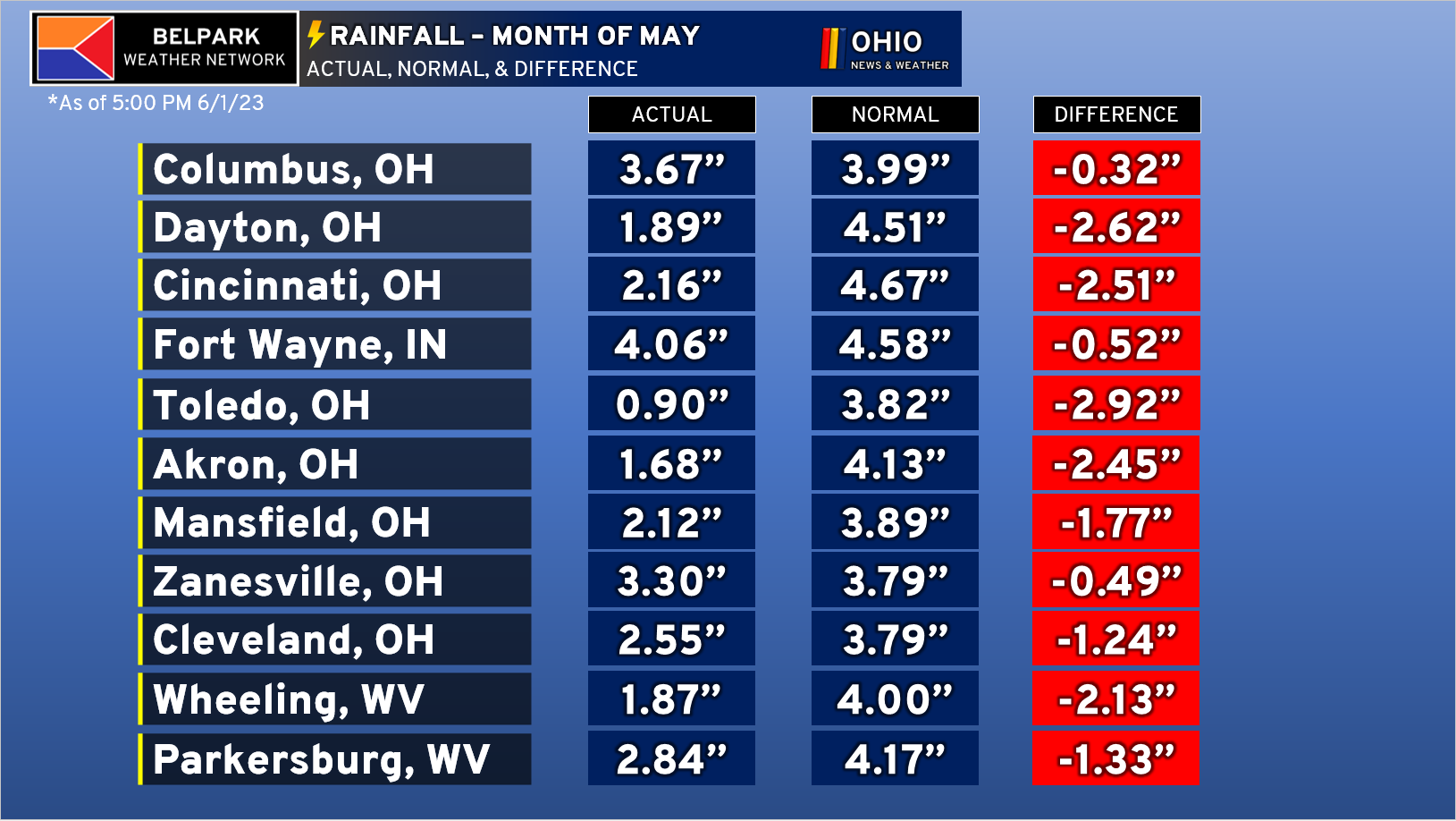
This deficit is interesting depending on where you lived. For instance, Columbus had 2.49″ of their 3.67″ for the month fall on one day, which was a record. Places like Toledo had 24 of 31 days in May without any measurable rainfall. This has led to abnormally dry weather, which is not the best news for farmers.
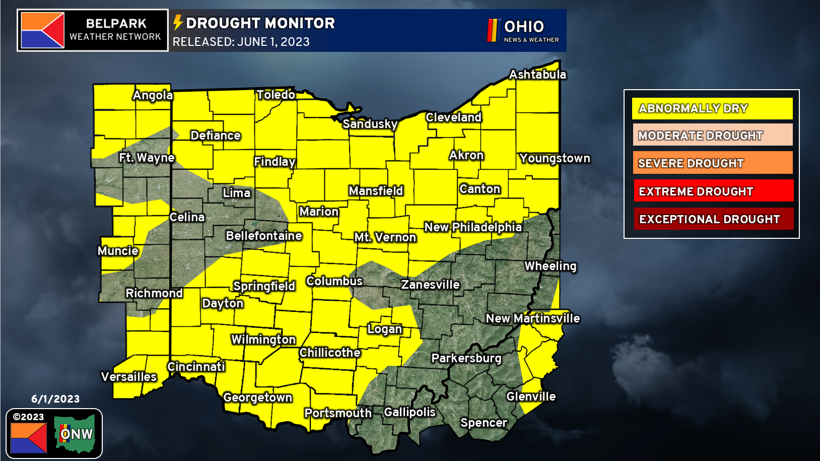
The weekly drought monitor released on 6/1/2023 shows much of the area is now considered Abnormally Dry (D-0). This is not a formal drought yet, but we are trending that way quickly.
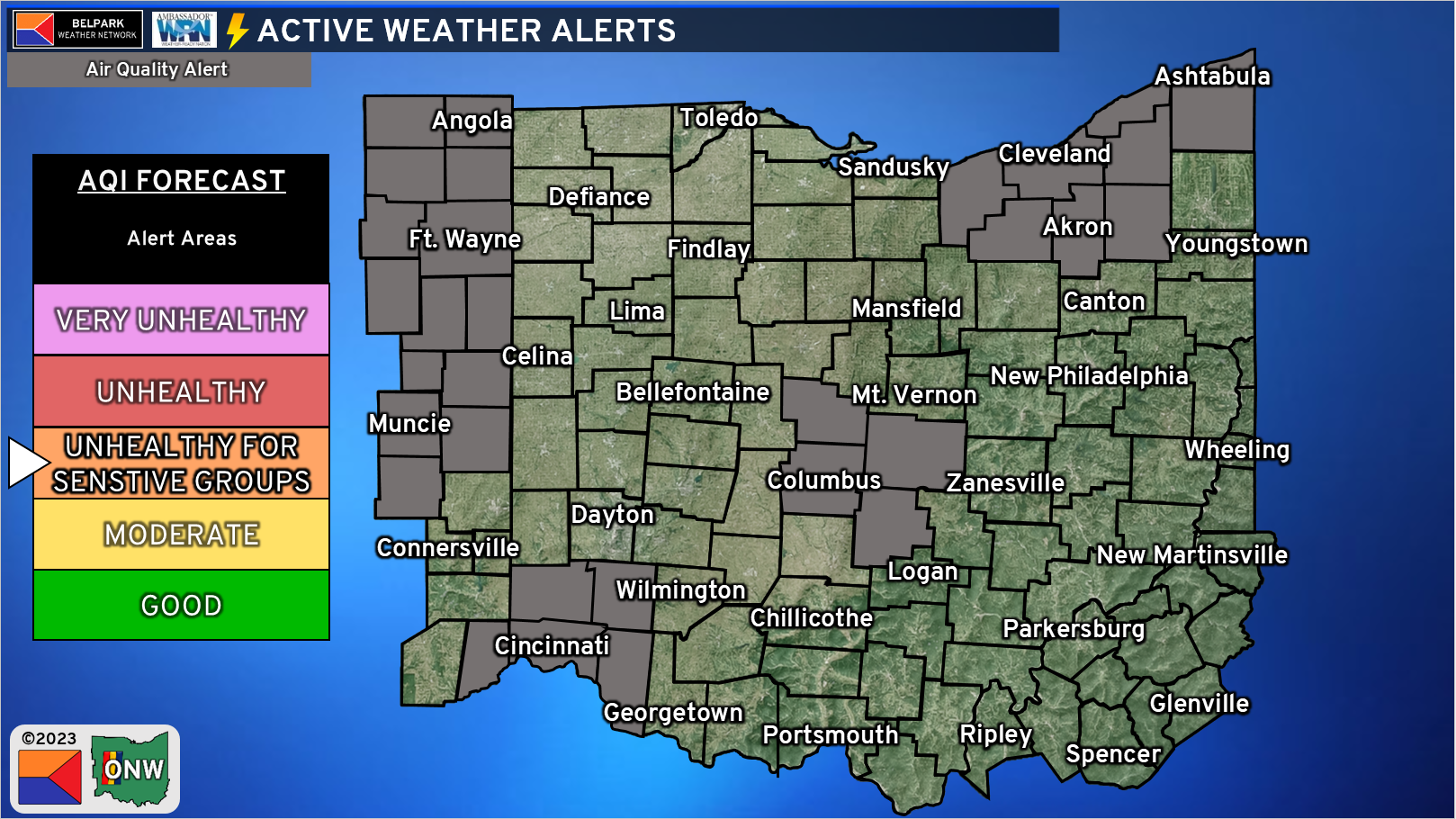
Another issue we have today is Air Quality! Due to stagnant air with high pressure overhead and in control, we have higher ozone levels that are in the Unhealthy for Sensitive Groups category. This means those with asthma or other medical conditions related to breathing issues should limit time outdoors if possible. Also, limit the refueling of vehicles and use of gas-powered equipment if possible.
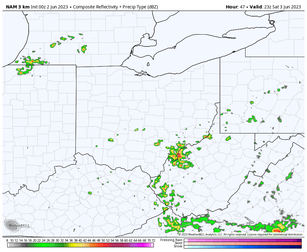
So, will we see any meaningful rain? Models try to pop some isolated to widely scattered activity on Saturday with the passage of a weak cold front. Our dry air mass may limit the activity we see, but it sure would be nice to see some rain!
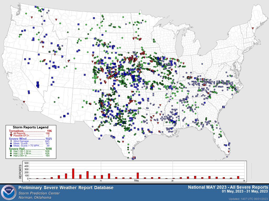
In addition to not having much in the way of rain for the majority of the month, this also means we have not seen much at all in the way of severe weather during what is typically our busiest time of the year! During the month of May, Ohio had exactly one report of severe weather in the form of a damaging wind gust caused by a downburst.
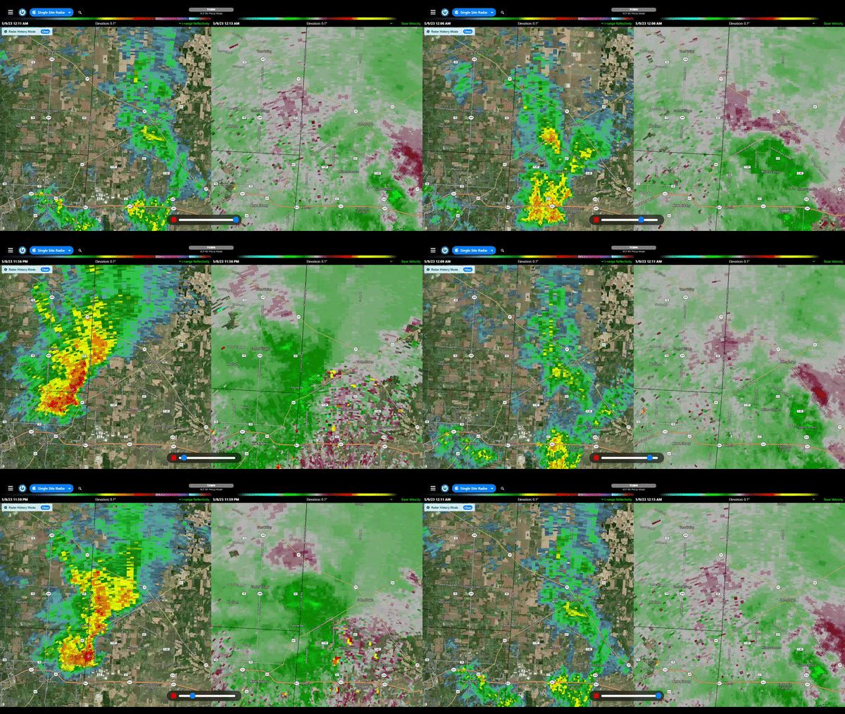

The above radar loop shows a downburst occurring just SW of Johnstown shortly after midnight on May 9th. The downburst was the storm likely collapsing on itself as it fizzled out shortly after causing damage to trees and power lines near U.S. 62. Since then, we have seen very little in the way of thunderstorm activity across the region. Overall most of the country has been below average in terms of severe weather this season. We aren’t done yet, around here we usually see severe weather through the month of June as well before things really heat up and dry out!
Looking Ahead
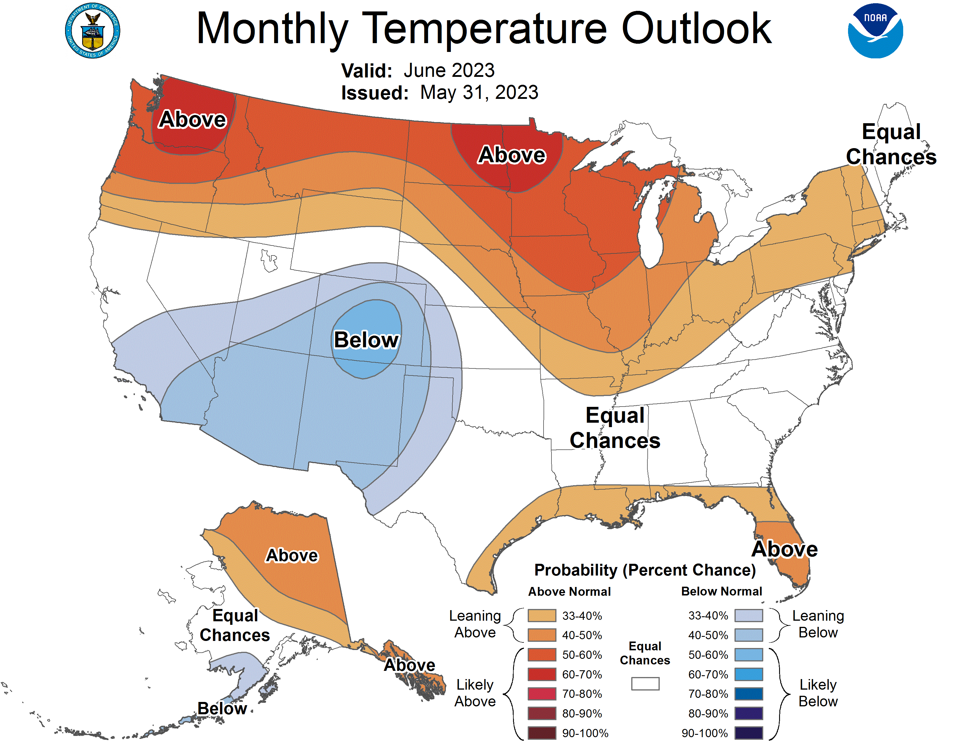
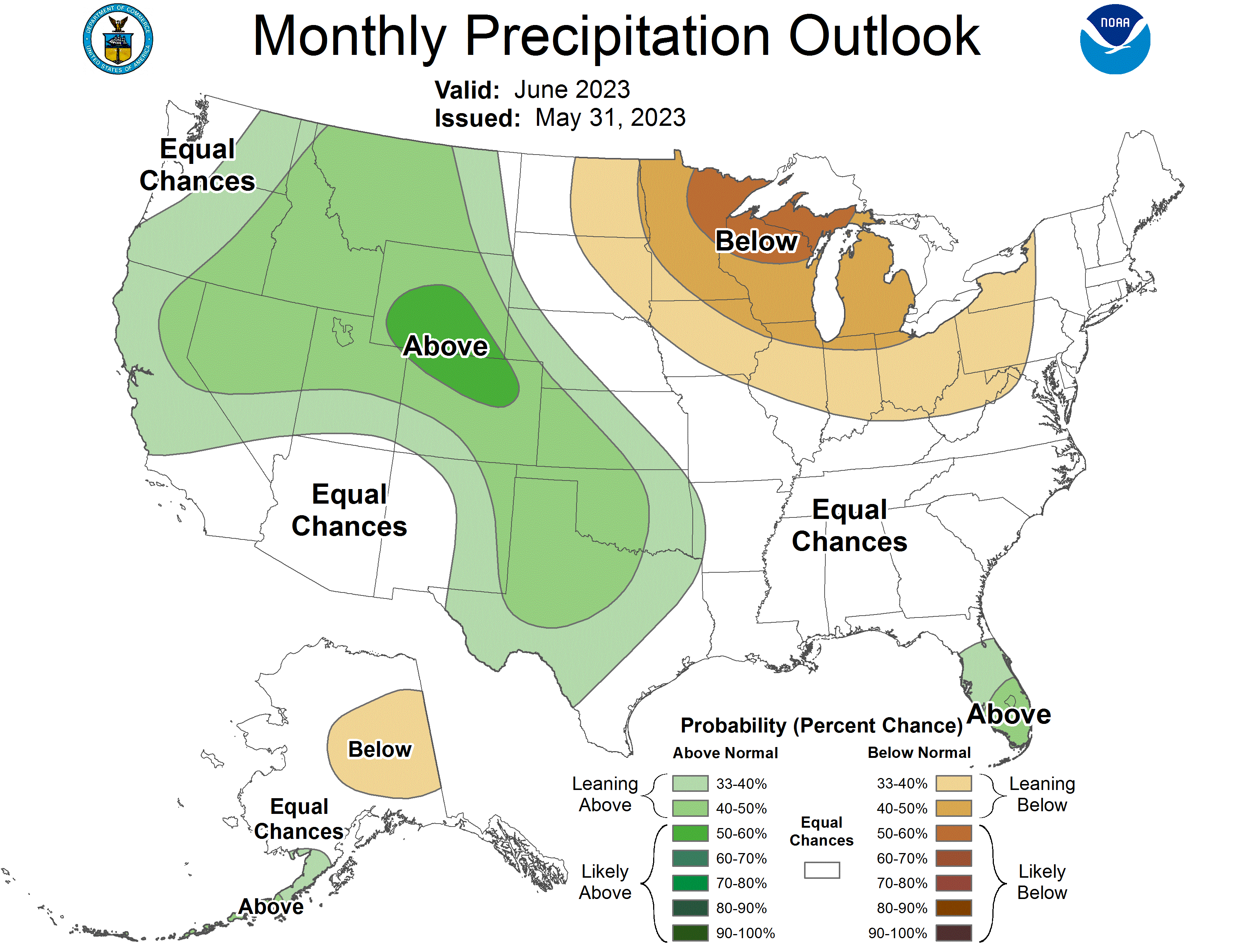
Looking ahead to the month of June, we are expecting temperatures to trend near normal to above average for the month, along with near to below normal precipitation. Given the already dry conditions this is going to be something to watch. Of course there will be some rain at some point, it needs to be enough and frequent enough to not only make up for what we already don’t have, it also needs to add enough water to the ground to combat another dry spell which isn’t totally uncommon in the month of June. It’s a big ask but our farmers out there are going to need all the help they can get.
Well that’s it for the Weather Roundup for the Month of May! We hope you enjoyed reading and if you have any questions you can leave your comments below or send us a message on Facebook!
